Znamenskoye geodata
Znamenskoye (Omsk) is a populated place; located in Russia in Asia/Omsk (GMT+6) time zone. With population of 13,300 people, there are 1185 cities with bigger population in this country. Compared to other cities in Russia, 78.1% of cities are located further ↓South; 78% of cities are located further ←West and 80.9% of cities have higher elevation than Znamenskoye. Note1


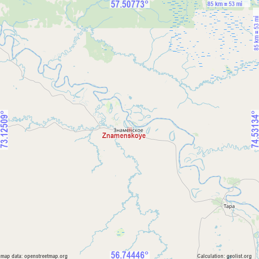
Znamenskoye GPS coordinates[2]
57° 7' 41.016" North, 73° 49' 41.556" East
| Map corner | latitude | longitude |
|---|---|---|
| Upper-left | 57.50773°, | 73.12509° |
| Center: | 57.12806°, | 73.82821° |
| Lower-right: | 56.74446°, | 74.53134° |
| Map W x H: | 84.9×84.9 km | = 52.8×52.8mi |
| max Lat: | 73.50819° ⇑21.9% North |
| Znamenskoye: | 57.12806° |
| min Lat: | ⇓78.1% South 41.28413° |
| min Long | Znamenskoye | max Long |
| -179.12198° | 73.82821° | 179.35046° |
| W 78%⇐ | ⇒22% E |
Elevation
Elevation of Znamenskoye is 68 m = 223 ft, and this is 134.6 m = 442 ft below average elevation for this country.
| Max E: |
2518 m = 8261 ft | 80.9% |
| Avg. | 202.6 m = 665 ft | |
| Znamenskoye | 68 m = 223 ft | |
Min E: |
-28 m = -92 ft | 19.1% |
See also: Russia elevation on elevation.city.
Geographical zone
Znamenskoye is located in North temperate zone (between Tropic of Cancer and the Arctic Circle). Distance of this North polar circle is 1049.1 km =651.9 mi to North.| Distance of | km | miles | from Znamenskoye |
|---|---|---|---|
| North Pole | 3655 | 2271.1 | to North |
| Arctic Circle | 1049.1 | 651.9 | to North |
| Tropic Cancer | 3746.1 | 2327.7 | to South |
| Equator | 6352 | 3946.9 | to South |


Nearby cities:
15 places around Znamenskoye: (largest is in red/bold)
• Bol’sherech’ye
125.1 km =77.7 mi,  156°
156°
• Kolosovka
74.6 km =46.4 mi,  190°
190°
• Krasnoyarka
204.3 km =126.9 mi, 192°
• Krutaya Gorka
199.6 km =124 mi, 190°
• Krutinka
189 km =117.4 mi,  228°
228°
• Kyshtovka
181.7 km =112.9 mi,  110°
110°
• Muromtsevo
120.4 km =74.8 mi,  134°
134°
• Nizhnyaya Omka
200.5 km =124.6 mi, 159°
• Sargatskoye
170 km =105.6 mi, 186°
• Tara
41.9 km =26 mi, 128°
• Tevriz
95.4 km =59.3 mi,  296°
296°
• Troitsk
186.5 km =115.9 mi,  211°
211°
• Tyukalinsk
171.7 km =106.7 mi,  215°
215°
• Ust’-Ishim
171.3 km =106.4 mi,  291°
291°
• Vikulovo
198 km =123 mi,  259°
259°
Sources, notices
• [Note1] Compared only with cities in Russia existing in our database
• [Src1] Map data: © OpenStreetMap contributors (CC-BY-SA)
• [Src2] Other city data from geonames.org with taken over terms of usage.
• [Src3] Geographical zone / Annual Mean Temperature by Robert A. Rohde @ Wikipedia
