Kyshtovka geodata
Kyshtovka (Novosibirsk Oblast) is a populated place; located in Russia in Asia/Novosibirsk (GMT+7) time zone. With population of 5,724 people, there are 2355 cities with bigger population in this country. Compared to other cities in Russia, 73.3% of cities are located further ↓South; 78.5% of cities are located further ←West and 75.8% of cities have higher elevation than Kyshtovka. Note1


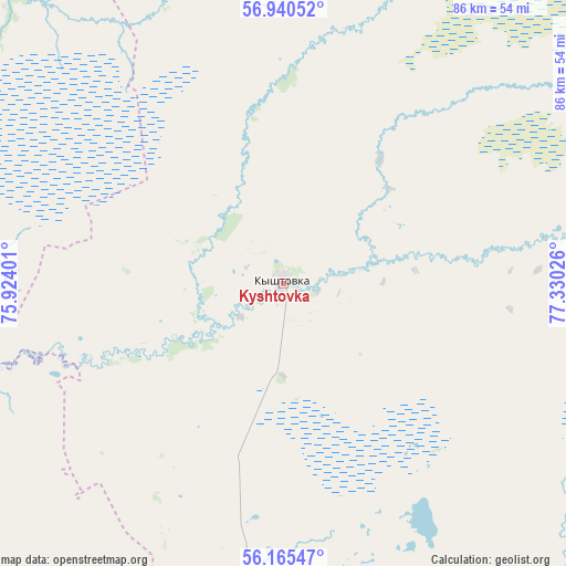
Kyshtovka GPS coordinates[2]
56° 33' 17.928" North, 76° 37' 37.668" East
| Map corner | latitude | longitude |
|---|---|---|
| Upper-left | 56.94052°, | 75.92401° |
| Center: | 56.55498°, | 76.62713° |
| Lower-right: | 56.16547°, | 77.33026° |
| Map W x H: | 86.2×86.2 km | = 53.6×53.6mi |
| max Lat: | 73.50819° ⇑26.7% North |
| Kyshtovka: | 56.55498° |
| min Lat: | ⇓73.3% South 41.28413° |
| min Long | Kyshtovka | max Long |
| -179.12198° | 76.62713° | 179.35046° |
| W 78.5%⇐ | ⇒21.5% E |
Elevation
Elevation of Kyshtovka is 85 m = 279 ft, and this is 117.6 m = 386 ft below average elevation for this country.
| Max E: |
2518 m = 8261 ft | 75.8% |
| Avg. | 202.6 m = 665 ft | |
| Kyshtovka | 85 m = 279 ft | |
Min E: |
-28 m = -92 ft | 24.2% |
See also: Russia elevation on elevation.city.
Geographical zone
Kyshtovka is located in North temperate zone (between Tropic of Cancer and the Arctic Circle). Distance of this North polar circle is 1112.8 km =691.5 mi to North.| Distance of | km | miles | from Kyshtovka |
|---|---|---|---|
| North Pole | 3718.7 | 2310.7 | to North |
| Arctic Circle | 1112.8 | 691.5 | to North |
| Tropic Cancer | 3682.4 | 2288.1 | to South |
| Equator | 6288.3 | 3907.4 | to South |


Nearby cities:
15 places around Kyshtovka: (largest is in red/bold)
• Barabinsk
171.3 km =106.4 mi,  141°
141°
• Bol’sherech’ye
133.6 km =83 mi,  247°
247°
• Chany
138.5 km =86.1 mi,  176°
176°
• Kedrovyy
205 km =127.4 mi,  58°
58°
• Kolosovka
185.3 km =115.1 mi,  267°
267°
• Kuybyshev
162.1 km =100.7 mi, 139°
• Muromtsevo
87.5 km =54.4 mi,  256°
256°
• Nizhnyaya Omka
162.8 km =101.2 mi,  220°
220°
• Severnoye
109 km =67.7 mi,  102°
102°
• Tagan
183 km =113.7 mi,  166°
166°
• Tara
142.7 km =88.7 mi,  285°
285°
• Tatarsk
153.9 km =95.6 mi,  195°
195°
• Ust’-Tarka
123.9 km =77 mi,  207°
207°
• Vengerovo
97 km =60.3 mi, 175°
• Znamenskoye
181.7 km =112.9 mi, 290°
Sources, notices
• [Note1] Compared only with cities in Russia existing in our database
• [Src1] Map data: © OpenStreetMap contributors (CC-BY-SA)
• [Src2] Other city data from geonames.org with taken over terms of usage.
• [Src3] Geographical zone / Annual Mean Temperature by Robert A. Rohde @ Wikipedia
