Zhemchuzhnyy geodata
Zhemchuzhnyy (Khakasiya Republic) is a populated place; located in Russia in Asia/Krasnoyarsk (GMT+7) time zone. With population of 802 people, there are 4753 cities with bigger population in this country. Compared to other cities in Russia, 51% of cities are located further ↑North; 85.7% of cities are located further ←West and 87.7% of cities have lower elevation than Zhemchuzhnyy. Note1


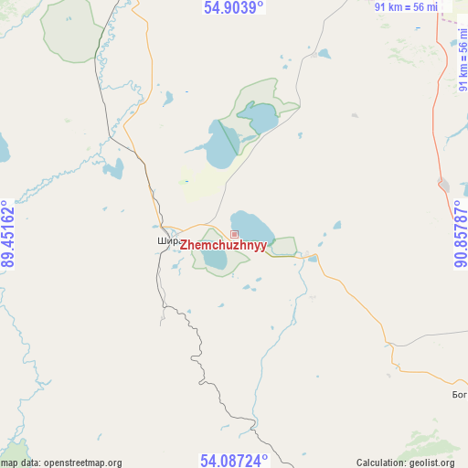
Zhemchuzhnyy GPS coordinates[2]
54° 29' 51.396" North, 90° 9' 17.064" East
| Map corner | latitude | longitude |
|---|---|---|
| Upper-left | 54.9039°, | 89.45162° |
| Center: | 54.49761°, | 90.15474° |
| Lower-right: | 54.08724°, | 90.85787° |
| Map W x H: | 90.8×90.8 km | = 56.4×56.4mi |
| max Lat: | 73.50819° ⇑51% North |
| Zhemchuzhnyy: | 54.49761° |
| min Lat: | ⇓49% South 41.28413° |
| min Long | Zhemchuzhnyy | max Long |
| -179.12198° | 90.15474° | 179.35046° |
| W 85.7%⇐ | ⇒14.3% E |
Elevation
Elevation of Zhemchuzhnyy is 388 m = 1273 ft, and this is 185.4 m = 608 ft above average elevation for this country.
| Max E: |
2518 m = 8261 ft | 12.3% |
| Zhemchuzhnyy | 388 m 1273 ft | |
| Avg. | 202.6 m = 665 ft | |
Min E: |
-28 m = -92 ft | 87.7% |
See also: Russia elevation on elevation.city.
Geographical zone
Zhemchuzhnyy is located in North temperate zone (between Tropic of Cancer and the Arctic Circle). Distance of this North polar circle is 1341.6 km =833.6 mi to North.| Distance of | km | miles | from Zhemchuzhnyy |
|---|---|---|---|
| North Pole | 3947.5 | 2452.9 | to North |
| Arctic Circle | 1341.6 | 833.6 | to North |
| Tropic Cancer | 3453.6 | 2146 | to South |
| Equator | 6059.6 | 3765.3 | to South |


Nearby cities:
15 places around Zhemchuzhnyy: (largest is in red/bold)
• Abakan
120.3 km =74.8 mi,  136°
136°
• Belogorsk
121.5 km =75.5 mi,  298°
298°
• Belyy Yar
128 km =79.5 mi, 140°
• Biskamzha
123.5 km =76.7 mi,  199°
199°
• Bograd
52.8 km =32.8 mi,  123°
123°
• Chernogorsk
105 km =65.2 mi, 135°
• Goryachegorsk
127.9 km =79.5 mi,  321°
321°
• Kommunar
58.8 km =36.5 mi,  253°
253°
• Krasnoturansk
93.3 km =58 mi,  102°
102°
• Sayansk
118.7 km =73.8 mi,  109°
109°
• Shira
13 km =8.1 mi,  266°
266°
• Sorsk
55.3 km =34.4 mi,  173°
173°
• Tuim
22.2 km =13.8 mi,  217°
217°
• Ust’-Abakan
109 km =67.7 mi,  132°
132°
• Uzhur
92.9 km =57.7 mi,  347°
347°
Sources, notices
• [Note1] Compared only with cities in Russia existing in our database
• [Src1] Map data: © OpenStreetMap contributors (CC-BY-SA)
• [Src2] Other city data from geonames.org with taken over terms of usage.
• [Src3] Geographical zone / Annual Mean Temperature by Robert A. Rohde @ Wikipedia
