Belogorsk geodata
Belogorsk (Kemerovo Oblast) is a populated place; located in Russia in Asia/Novokuznetsk (GMT+7) time zone. With population of 3,452 people, there are 3432 cities with bigger population in this country. Compared to other cities in Russia, 53.5% of cities are located further ↓South; 85.3% of cities are located further ←West and 96.1% of cities have lower elevation than Belogorsk. Note1


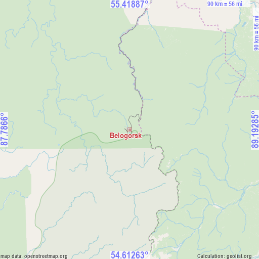
Belogorsk GPS coordinates[2]
55° 1' 4.008" North, 88° 29' 22.992" East
| Map corner | latitude | longitude |
|---|---|---|
| Upper-left | 55.41887°, | 87.7866° |
| Center: | 55.01778°, | 88.48972° |
| Lower-right: | 54.61263°, | 89.19285° |
| Map W x H: | 89.6×89.6 km | = 55.7×55.7mi |
| max Lat: | 73.50819° ⇑46.5% North |
| Belogorsk: | 55.01778° |
| min Lat: | ⇓53.5% South 41.28413° |
| min Long | Belogorsk | max Long |
| -179.12198° | 88.48972° | 179.35046° |
| W 85.3%⇐ | ⇒14.7% E |
Elevation
Elevation of Belogorsk is 703 m = 2306 ft, and this is 500.4 m = 1642 ft above average elevation for this country.
| Max E: |
2518 m = 8261 ft | 3.9% |
| Belogorsk | 703 m 2306 ft | |
| Avg. | 202.6 m = 665 ft | |
Min E: |
-28 m = -92 ft | 96.1% |
See also: Russia elevation on elevation.city.
Geographical zone
Belogorsk is located in North temperate zone (between Tropic of Cancer and the Arctic Circle). Distance of this North polar circle is 1283.8 km =797.7 mi to North.| Distance of | km | miles | from Belogorsk |
|---|---|---|---|
| North Pole | 3889.7 | 2416.9 | to North |
| Arctic Circle | 1283.8 | 797.7 | to North |
| Tropic Cancer | 3511.5 | 2181.9 | to South |
| Equator | 6117.4 | 3801.2 | to South |


Nearby cities:
15 places around Belogorsk: (largest is in red/bold)
• Chistogorskiy
135.3 km =84.1 mi,  211°
211°
• Dubinino
76.9 km =47.8 mi,  29°
29°
• Goryachegorsk
50.5 km =31.4 mi, 32°
• Itatskiy
122 km =75.8 mi,  16°
16°
• Kommunar
90.2 km =56 mi,  145°
145°
• Krapivinskiy
106.9 km =66.4 mi,  268°
268°
• Sharypovo
73.5 km =45.7 mi,  37°
37°
• Shira
110.7 km =68.8 mi,  121°
121°
• Tisul’
83.5 km =51.9 mi,  352°
352°
• Tuim
120.2 km =74.7 mi,  128°
128°
• Tyazhinskiy
122.1 km =75.9 mi,  0°
0°
• Uzhur
91.4 km =56.8 mi,  68°
68°
• Verkh-Chebula
125.2 km =77.8 mi,  334°
334°
• Zelenogorskiy
95 km =59 mi, 271°
• Zhemchuzhnyy
121.5 km =75.5 mi, 118°
Sources, notices
• [Note1] Compared only with cities in Russia existing in our database
• [Src1] Map data: © OpenStreetMap contributors (CC-BY-SA)
• [Src2] Other city data from geonames.org with taken over terms of usage.
• [Src3] Geographical zone / Annual Mean Temperature by Robert A. Rohde @ Wikipedia
