Zarinsk geodata
Zarinsk (Altai Krai) is a populated place; located in Russia in Asia/Barnaul (GMT+7) time zone. With population of 52,209 people, there are 401 cities with bigger population in this country. Compared to other cities in Russia, 57.4% of cities are located further ↑North; 82.2% of cities are located further ←West and 62.9% of cities have lower elevation than Zarinsk. Note1


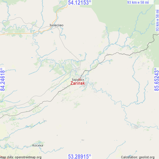
Zarinsk GPS coordinates[2]
53° 42' 26.64" North, 84° 56' 57.48" East
| Map corner | latitude | longitude |
|---|---|---|
| Upper-left | 54.12153°, | 84.24618° |
| Center: | 53.7074°, | 84.9493° |
| Lower-right: | 53.28915°, | 85.65243° |
| Map W x H: | 92.6×92.5 km | = 57.5×57.5mi |
| max Lat: | 73.50819° ⇑57.4% North |
| Zarinsk: | 53.7074° |
| min Lat: | ⇓42.6% South 41.28413° |
| min Long | Zarinsk | max Long |
| -179.12198° | 84.9493° | 179.35046° |
| W 82.2%⇐ | ⇒17.8% E |
Elevation
Elevation of Zarinsk is 176 m = 577 ft, and this is 26.6 m = 87 ft below average elevation for this country.
| Max E: |
2518 m = 8261 ft | 37.1% |
| Avg. | 202.6 m = 665 ft | |
| Zarinsk | 176 m = 577 ft | |
Min E: |
-28 m = -92 ft | 62.9% |
See also: Zarinsk elevation on elevation.city.
Geographical zone
Zarinsk is located in North temperate zone (between Tropic of Cancer and the Arctic Circle). Distance of this North polar circle is 1429.5 km =888.2 mi to North.| Distance of | km | miles | from Zarinsk |
|---|---|---|---|
| North Pole | 4035.4 | 2507.5 | to North |
| Arctic Circle | 1429.5 | 888.2 | to North |
| Tropic Cancer | 3365.8 | 2091.4 | to South |
| Equator | 5971.7 | 3710.6 | to South |


Nearby cities:
15 places around Zarinsk: (largest is in red/bold)
• Antipino
74 km =46 mi,  127°
127°
• Bayunovskiye Klyuchi
66 km =41 mi,  230°
230°
• Beloyarsk
74.8 km =46.5 mi,  247°
247°
• Kosikha
45.5 km =28.3 mi,  212°
212°
• Kytmanovo
42.9 km =26.7 mi, 129°
• Logovskoye
54.7 km =34 mi,  244°
244°
• Nalobikha
60.9 km =37.8 mi,  202°
202°
• Novoaltaysk
75.6 km =47 mi, 242°
• Pervomayskoye
61.3 km =38.1 mi,  271°
271°
• Sannikovo
76 km =47.2 mi, 237°
• Sorokino
5.2 km =3.2 mi,  335°
335°
• Staryy Togul
70 km =43.5 mi,  116°
116°
• Togul
69 km =42.9 mi,  112°
112°
• Zalesovo
34.6 km =21.5 mi, 336°
• Zudilovo
73.6 km =45.7 mi, 251°
Sources, notices
• [Note1] Compared only with cities in Russia existing in our database
• [Src1] Map data: © OpenStreetMap contributors (CC-BY-SA)
• [Src2] Other city data from geonames.org with taken over terms of usage.
• [Src3] Geographical zone / Annual Mean Temperature by Robert A. Rohde @ Wikipedia
