Pervomayskoye geodata
Pervomayskoye (Altai Krai) is a populated place; located in Russia in Asia/Barnaul (GMT+7) time zone. With population of 5,103 people, there are 2608 cities with bigger population in this country. Compared to other cities in Russia, 57.3% of cities are located further ↑North; 81.5% of cities are located further ←West and 68.4% of cities have lower elevation than Pervomayskoye. Note1


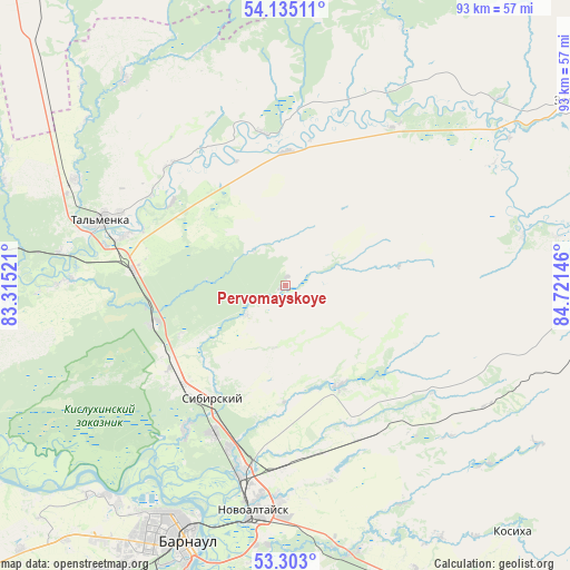
Pervomayskoye GPS coordinates[2]
53° 43' 15.996" North, 84° 1' 5.988" East
| Map corner | latitude | longitude |
|---|---|---|
| Upper-left | 54.13511°, | 83.31521° |
| Center: | 53.72111°, | 84.01833° |
| Lower-right: | 53.303°, | 84.72146° |
| Map W x H: | 92.5×92.5 km | = 57.5×57.5mi |
| max Lat: | 73.50819° ⇑57.3% North |
| Pervomayskoye: | 53.72111° |
| min Lat: | ⇓42.7% South 41.28413° |
| min Long | Pervomayskoye | max Long |
| -179.12198° | 84.01833° | 179.35046° |
| W 81.5%⇐ | ⇒18.5% E |
Elevation
Elevation of Pervomayskoye is 192 m = 630 ft, and this is 10.6 m = 35 ft below average elevation for this country.
| Max E: |
2518 m = 8261 ft | 31.6% |
| Avg. | 202.6 m = 665 ft | |
| Pervomayskoye | 192 m = 630 ft | |
Min E: |
-28 m = -92 ft | 68.4% |
See also: Russia elevation on elevation.city.
Geographical zone
Pervomayskoye is located in North temperate zone (between Tropic of Cancer and the Arctic Circle). Distance of this North polar circle is 1427.9 km =887.3 mi to North.| Distance of | km | miles | from Pervomayskoye |
|---|---|---|---|
| North Pole | 4033.8 | 2506.5 | to North |
| Arctic Circle | 1427.9 | 887.3 | to North |
| Tropic Cancer | 3367.3 | 2092.3 | to South |
| Equator | 5973.2 | 3711.6 | to South |


Nearby cities:
15 places around Pervomayskoye: (largest is in red/bold)
• Barnaul
43.5 km =27 mi,  202°
202°
• Bayunovskiye Klyuchi
45 km =28 mi,  166°
166°
• Beloyarsk
31.5 km =19.6 mi,  193°
193°
• Borovikha
26.6 km =16.5 mi,  206°
206°
• Firsovo
45.1 km =28 mi, 185°
• Gon’ba
44.7 km =27.8 mi,  220°
220°
• Logovskoye
28 km =17.4 mi,  154°
154°
• Nauchnyy Gorodok
46.9 km =29.1 mi, 224°
• Novoaltaysk
37 km =23 mi, 188°
• Novosilikatnyy
52.7 km =32.7 mi, 209°
• Sannikovo
41.9 km =26 mi,  183°
183°
• Sibirskiy
23.4 km =14.5 mi,  227°
227°
• Tal’menka
31.5 km =19.6 mi,  290°
290°
• Zaton
49.5 km =30.8 mi, 196°
• Zudilovo
26.7 km =16.6 mi, 197°
Sources, notices
• [Note1] Compared only with cities in Russia existing in our database
• [Src1] Map data: © OpenStreetMap contributors (CC-BY-SA)
• [Src2] Other city data from geonames.org with taken over terms of usage.
• [Src3] Geographical zone / Annual Mean Temperature by Robert A. Rohde @ Wikipedia
