Lyubinskiy geodata
Lyubinskiy (Omsk) is a populated place; located in Russia in Asia/Omsk (GMT+6) time zone. With population of 10,461 people, there are 1448 cities with bigger population in this country. Compared to other cities in Russia, 54.9% of cities are located further ↓South; 77.5% of cities are located further ←West and 65% of cities have higher elevation than Lyubinskiy. Note1


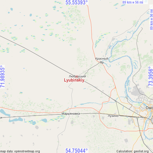
Lyubinskiy GPS coordinates[2]
55° 9' 15.156" North, 72° 41' 32.892" East
| Map corner | latitude | longitude |
|---|---|---|
| Upper-left | 55.55393°, | 71.98935° |
| Center: | 55.15421°, | 72.69247° |
| Lower-right: | 54.75044°, | 73.3956° |
| Map W x H: | 89.3×89.3 km | = 55.5×55.5mi |
| max Lat: | 73.50819° ⇑45.1% North |
| Lyubinskiy: | 55.15421° |
| min Lat: | ⇓54.9% South 41.28413° |
| min Long | Lyubinskiy | max Long |
| -179.12198° | 72.69247° | 179.35046° |
| W 77.5%⇐ | ⇒22.5% E |
Elevation
Elevation of Lyubinskiy is 114 m = 374 ft, and this is 88.6 m = 291 ft below average elevation for this country.
| Max E: |
2518 m = 8261 ft | 65% |
| Avg. | 202.6 m = 665 ft | |
| Lyubinskiy | 114 m = 374 ft | |
Min E: |
-28 m = -92 ft | 35% |
See also: Russia elevation on elevation.city.
Geographical zone
Lyubinskiy is located in North temperate zone (between Tropic of Cancer and the Arctic Circle). Distance of this North polar circle is 1268.6 km =788.3 mi to North.| Distance of | km | miles | from Lyubinskiy |
|---|---|---|---|
| North Pole | 3874.5 | 2407.5 | to North |
| Arctic Circle | 1268.6 | 788.3 | to North |
| Tropic Cancer | 3526.7 | 2191.4 | to South |
| Equator | 6132.6 | 3810.6 | to South |


Nearby cities:
15 places around Lyubinskiy: (largest is in red/bold)
• Azovo
54.8 km =34.1 mi,  157°
157°
• Beregovoy
33.6 km =20.9 mi,  86°
86°
• Irtyshskiy
68.5 km =42.6 mi,  123°
123°
• Krasnoyarka
33.5 km =20.8 mi,  53°
53°
• Krasnyy Yar
17.8 km =11.1 mi,  56°
56°
• Krutaya Gorka
41 km =25.5 mi, 55°
• Luzino
31.7 km =19.7 mi,  136°
136°
• Novoomskiy
52.1 km =32.4 mi,  131°
131°
• Omsk
46.6 km =29 mi,  112°
112°
• Rostovka
57 km =35.4 mi,  296°
296°
• Sargatskoye
71.8 km =44.6 mi, 45°
• Sherbakul’
61.1 km =38 mi,  198°
198°
• Troitsk
67.4 km =41.9 mi,  334°
334°
• Tyukalinsk
85.8 km =53.3 mi,  338°
338°
• Vkhodnoy
37.9 km =23.5 mi, 126°
Sources, notices
• [Note1] Compared only with cities in Russia existing in our database
• [Src1] Map data: © OpenStreetMap contributors (CC-BY-SA)
• [Src2] Other city data from geonames.org with taken over terms of usage.
• [Src3] Geographical zone / Annual Mean Temperature by Robert A. Rohde @ Wikipedia
