Lebyazh’ye geodata
Lebyazh’ye (Kurgan Oblast) is a populated place; located in Russia in Asia/Yekaterinburg (GMT+5) time zone. With population of 6,900 people, there are 2026 cities with bigger population in this country. Compared to other cities in Russia, 55.9% of cities are located further ↓South; 76.4% of cities are located further ←West and 53.1% of cities have higher elevation than Lebyazh’ye. Note1


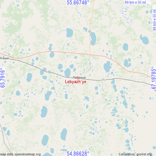
Lebyazh’ye GPS coordinates[2]
55° 16' 8.004" North, 66° 29' 40.992" East
| Map corner | latitude | longitude |
|---|---|---|
| Upper-left | 55.66746°, | 65.7916° |
| Center: | 55.26889°, | 66.49472° |
| Lower-right: | 54.86628°, | 67.19785° |
| Map W x H: | 89.1×89.1 km | = 55.4×55.4mi |
| max Lat: | 73.50819° ⇑44.1% North |
| Lebyazh’ye: | 55.26889° |
| min Lat: | ⇓55.9% South 41.28413° |
| min Long | Lebyazh’ye | max Long |
| -179.12198° | 66.49472° | 179.35046° |
| W 76.4%⇐ | ⇒23.6% E |
Elevation
Elevation of Lebyazh’ye is 138 m = 453 ft, and this is 64.6 m = 212 ft below average elevation for this country.
| Max E: |
2518 m = 8261 ft | 53.1% |
| Avg. | 202.6 m = 665 ft | |
| Lebyazh’ye | 138 m = 453 ft | |
Min E: |
-28 m = -92 ft | 46.9% |
See also: Russia elevation on elevation.city.
Geographical zone
Lebyazh’ye is located in North temperate zone (between Tropic of Cancer and the Arctic Circle). Distance of this North polar circle is 1255.8 km =780.3 mi to North.| Distance of | km | miles | from Lebyazh’ye |
|---|---|---|---|
| North Pole | 3861.7 | 2399.5 | to North |
| Arctic Circle | 1255.8 | 780.3 | to North |
| Tropic Cancer | 3539.4 | 2199.3 | to South |
| Equator | 6145.3 | 3818.5 | to South |


Nearby cities:
15 places around Lebyazh’ye: (largest is in red/bold)
• Armizonskoye
105.6 km =65.6 mi,  44°
44°
• Belozërskoye
84 km =52.2 mi,  317°
317°
• Glyadyanskoye
98.1 km =61 mi,  245°
245°
• Ikovka
105.2 km =65.4 mi,  291°
291°
• Ketovo
74.6 km =46.4 mi,  277°
277°
• Krasnyy Oktyabr’
114.4 km =71.1 mi, 292°
• Kurgan
76.1 km =47.3 mi, 285°
• Lesnikovo
74.6 km =46.4 mi,  271°
271°
• Makushino
48 km =29.8 mi,  97°
97°
• Mokrousovo
62.6 km =38.9 mi,  15°
15°
• Petukhovo
92.1 km =57.2 mi, 103°
• Polovinnoye
62.2 km =38.6 mi,  211°
211°
• Prosvet
95.2 km =59.2 mi, 290°
• Vargashi
42.1 km =26.2 mi, 283°
• Vvedenskoye
92 km =57.2 mi, 284°
Sources, notices
• [Note1] Compared only with cities in Russia existing in our database
• [Src1] Map data: © OpenStreetMap contributors (CC-BY-SA)
• [Src2] Other city data from geonames.org with taken over terms of usage.
• [Src3] Geographical zone / Annual Mean Temperature by Robert A. Rohde @ Wikipedia
