Krasnyy Oktyabr’ geodata
Krasnyy Oktyabr’ (Kurgan Oblast) is a populated place; located in Russia in Asia/Yekaterinburg (GMT+5) time zone. With population of 4,084 people, there are 3062 cities with bigger population in this country. Compared to other cities in Russia, 60.9% of cities are located further ↓South; 75.7% of cities are located further ←West and 59.2% of cities have higher elevation than Krasnyy Oktyabr’. Note1


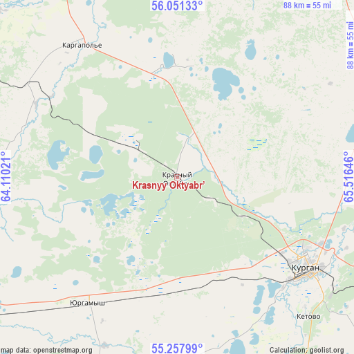
Krasnyy Oktyabr’ GPS coordinates[2]
55° 39' 24.012" North, 64° 48' 47.988" East
| Map corner | latitude | longitude |
|---|---|---|
| Upper-left | 56.05133°, | 64.11021° |
| Center: | 55.65667°, | 64.81333° |
| Lower-right: | 55.25799°, | 65.51646° |
| Map W x H: | 88.2×88.2 km | = 54.8×54.8mi |
| max Lat: | 73.50819° ⇑39.1% North |
| Krasnyy Oktyabr’: | 55.65667° |
| min Lat: | ⇓60.9% South 41.28413° |
| min Long | Krasnyy Oktyabr | max Long |
| -179.12198° | 64.81333° | 179.35046° |
| W 75.7%⇐ | ⇒24.3% E |
Elevation
Elevation of Krasnyy Oktyabr’ is 126 m = 413 ft, and this is 76.6 m = 251 ft below average elevation for this country.
| Max E: |
2518 m = 8261 ft | 59.2% |
| Avg. | 202.6 m = 665 ft | |
| Krasnyy Oktyabr’ | 126 m = 413 ft | |
Min E: |
-28 m = -92 ft | 40.8% |
See also: Russia elevation on elevation.city.
Geographical zone
Krasnyy Oktyabr’ is located in North temperate zone (between Tropic of Cancer and the Arctic Circle). Distance of this North polar circle is 1212.7 km =753.5 mi to North.| Distance of | km | miles | from Krasnyy Oktyabr’ |
|---|---|---|---|
| North Pole | 3818.6 | 2372.8 | to North |
| Arctic Circle | 1212.7 | 753.5 | to North |
| Tropic Cancer | 3582.5 | 2226.1 | to South |
| Equator | 6188.4 | 3845.3 | to South |


Nearby cities:
15 places around Krasnyy Oktyabr’: (largest is in red/bold)
• Belozërskoye
51.6 km =32.1 mi,  69°
69°
• Glyadyanskoye
85.1 km =52.9 mi,  168°
168°
• Ikovka
9.4 km =5.8 mi,  124°
124°
• Isetskoye
97.5 km =60.6 mi,  18°
18°
• Ketovo
46.5 km =28.9 mi,  136°
136°
• Kurgan
40 km =24.9 mi,  125°
125°
• Kurtamysh
86.4 km =53.7 mi,  196°
196°
• Lesnikovo
52.4 km =32.6 mi, 142°
• Mishkino
66.6 km =41.4 mi,  237°
237°
• Prosvet
19.4 km =12.1 mi, 119°
• Shadrinsk
87.7 km =54.5 mi,  302°
302°
• Shatrovo
96.6 km =60 mi,  353°
353°
• Vargashi
73.2 km =45.5 mi, 117°
• Vvedenskoye
26.5 km =16.5 mi, 139°
• Yurgamysh
38.4 km =23.9 mi,  215°
215°
Sources, notices
• [Note1] Compared only with cities in Russia existing in our database
• [Src1] Map data: © OpenStreetMap contributors (CC-BY-SA)
• [Src2] Other city data from geonames.org with taken over terms of usage.
• [Src3] Geographical zone / Annual Mean Temperature by Robert A. Rohde @ Wikipedia
