Petukhovo geodata
Petukhovo (Kurgan Oblast) is a populated place; located in Russia in Asia/Yekaterinburg (GMT+5) time zone. With population of 12,367 people, there are 1242 cities with bigger population in this country. Compared to other cities in Russia, 54.2% of cities are located further ↓South; 76.7% of cities are located further ←West and 53.6% of cities have higher elevation than Petukhovo. Note1


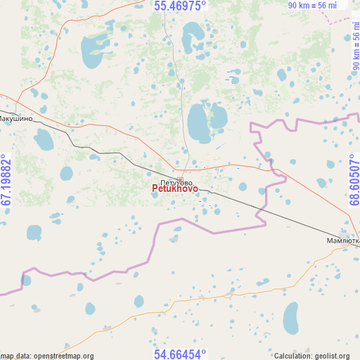
Petukhovo GPS coordinates[2]
55° 4' 9.012" North, 67° 54' 6.984" East
| Map corner | latitude | longitude |
|---|---|---|
| Upper-left | 55.46975°, | 67.19882° |
| Center: | 55.06917°, | 67.90194° |
| Lower-right: | 54.66454°, | 68.60507° |
| Map W x H: | 89.5×89.5 km | = 55.6×55.6mi |
| max Lat: | 73.50819° ⇑45.8% North |
| Petukhovo: | 55.06917° |
| min Lat: | ⇓54.2% South 41.28413° |
| min Long | Petukhovo | max Long |
| -179.12198° | 67.90194° | 179.35046° |
| W 76.7%⇐ | ⇒23.3% E |
Elevation
Elevation of Petukhovo is 137 m = 449 ft, and this is 65.6 m = 215 ft below average elevation for this country.
| Max E: |
2518 m = 8261 ft | 53.6% |
| Avg. | 202.6 m = 665 ft | |
| Petukhovo | 137 m = 449 ft | |
Min E: |
-28 m = -92 ft | 46.4% |
See also: Russia elevation on elevation.city.
Geographical zone
Petukhovo is located in North temperate zone (between Tropic of Cancer and the Arctic Circle). Distance of this North polar circle is 1278.1 km =794.2 mi to North.| Distance of | km | miles | from Petukhovo |
|---|---|---|---|
| North Pole | 3883.9 | 2413.3 | to North |
| Arctic Circle | 1278.1 | 794.2 | to North |
| Tropic Cancer | 3517.2 | 2185.5 | to South |
| Equator | 6123.1 | 3804.7 | to South |


Nearby cities:
15 places around Petukhovo: (largest is in red/bold)
• Armizonskoye
98.6 km =61.3 mi,  351°
351°
• Golyshmanovo
150.7 km =93.6 mi,  11°
11°
• Ishim
153 km =95.1 mi,  40°
40°
• Kazanskoye
105.8 km =65.7 mi,  52°
52°
• Ketovo
166.5 km =103.5 mi,  281°
281°
• Kurgan
168.2 km =104.5 mi, 284°
• Lebyazh’ye
92.1 km =57.2 mi, 283°
• Lesnikovo
165.8 km =103 mi, 278°
• Makushino
44.7 km =27.8 mi,  290°
290°
• Mokrousovo
109.2 km =67.9 mi,  318°
318°
• Novoseleznëvo
106.9 km =66.4 mi, 50°
• Omutinskiy
156.9 km =97.5 mi, 354°
• Polovinnoye
126.2 km =78.4 mi,  255°
255°
• Sladkovo
162.5 km =101 mi,  71°
71°
• Vargashi
134.2 km =83.4 mi, 283°
Sources, notices
• [Note1] Compared only with cities in Russia existing in our database
• [Src1] Map data: © OpenStreetMap contributors (CC-BY-SA)
• [Src2] Other city data from geonames.org with taken over terms of usage.
• [Src3] Geographical zone / Annual Mean Temperature by Robert A. Rohde @ Wikipedia
