Mishkino geodata
Mishkino (Kurgan Oblast) is a populated place; located in Russia in Asia/Yekaterinburg (GMT+5) time zone. With population of 8,712 people, there are 1693 cities with bigger population in this country. Compared to other cities in Russia, 56.6% of cities are located further ↓South; 75.3% of cities are located further ←West and 52.8% of cities have lower elevation than Mishkino. Note1


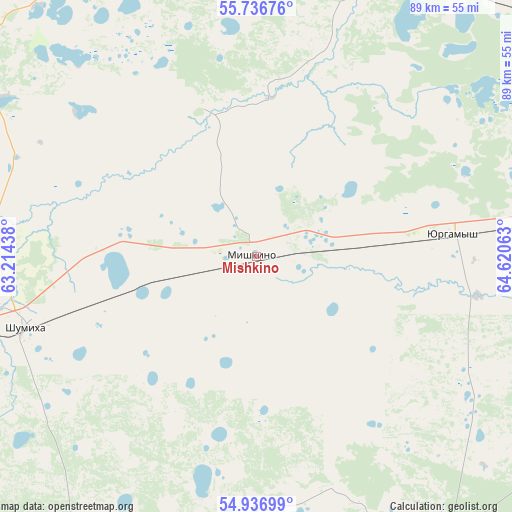
Mishkino GPS coordinates[2]
55° 20' 20.004" North, 63° 55' 3" East
| Map corner | latitude | longitude |
|---|---|---|
| Upper-left | 55.73676°, | 63.21438° |
| Center: | 55.33889°, | 63.9175° |
| Lower-right: | 54.93699°, | 64.62063° |
| Map W x H: | 88.9×88.9 km | = 55.2×55.2mi |
| max Lat: | 73.50819° ⇑43.4% North |
| Mishkino: | 55.33889° |
| min Lat: | ⇓56.6% South 41.28413° |
| min Long | Mishkino | max Long |
| -179.12198° | 63.9175° | 179.35046° |
| W 75.3%⇐ | ⇒24.7% E |
Elevation
Elevation of Mishkino is 151 m = 495 ft, and this is 51.6 m = 169 ft below average elevation for this country.
| Max E: |
2518 m = 8261 ft | 47.2% |
| Avg. | 202.6 m = 665 ft | |
| Mishkino | 151 m = 495 ft | |
Min E: |
-28 m = -92 ft | 52.8% |
See also: Russia elevation on elevation.city.
Geographical zone
Mishkino is located in North temperate zone (between Tropic of Cancer and the Arctic Circle). Distance of this North polar circle is 1248.1 km =775.5 mi to North.| Distance of | km | miles | from Mishkino |
|---|---|---|---|
| North Pole | 3854 | 2394.8 | to North |
| Arctic Circle | 1248.1 | 775.5 | to North |
| Tropic Cancer | 3547.2 | 2204.1 | to South |
| Equator | 6153.1 | 3823.4 | to South |


Nearby cities:
15 places around Mishkino: (largest is in red/bold)
• Glyadyanskoye
88.6 km =55.1 mi,  122°
122°
• Ikovka
70.9 km =44.1 mi,  64°
64°
• Ketovo
89.1 km =55.4 mi,  88°
88°
• Krasnyy Oktyabr’
66.6 km =41.4 mi, 57°
• Kurgan
90.3 km =56.1 mi,  82°
82°
• Kurtamysh
57.8 km =35.9 mi,  145°
145°
• Lesnikovo
88.8 km =55.2 mi, 94°
• Prosvet
77.8 km =48.3 mi,  70°
70°
• Safakulevo
95.5 km =59.3 mi,  246°
246°
• Shadrinsk
84.9 km =52.8 mi,  347°
347°
• Shumikha
41.3 km =25.7 mi, 252°
• Tselinnoye
94.4 km =58.7 mi,  189°
189°
• Vvedenskoye
75.2 km =46.7 mi, 78°
• Yurgamysh
34.7 km =21.6 mi, 83°
• Zverinogolovskoye
115.1 km =71.5 mi, 148°
Sources, notices
• [Note1] Compared only with cities in Russia existing in our database
• [Src1] Map data: © OpenStreetMap contributors (CC-BY-SA)
• [Src2] Other city data from geonames.org with taken over terms of usage.
• [Src3] Geographical zone / Annual Mean Temperature by Robert A. Rohde @ Wikipedia
