Izhmorskiy geodata
Izhmorskiy (Kemerovo Oblast) is a populated place; located in Russia in Asia/Novokuznetsk (GMT+7) time zone. With population of 5,950 people, there are 2269 cities with bigger population in this country. Compared to other cities in Russia, 69.2% of cities are located further ↓South; 84.4% of cities are located further ←West and 78.9% of cities have lower elevation than Izhmorskiy. Note1


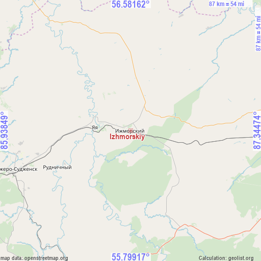
Izhmorskiy GPS coordinates[2]
56° 11' 32.604" North, 86° 38' 29.796" East
| Map corner | latitude | longitude |
|---|---|---|
| Upper-left | 56.58162°, | 85.93849° |
| Center: | 56.19239°, | 86.64161° |
| Lower-right: | 55.79917°, | 87.34474° |
| Map W x H: | 87×87 km | = 54.1×54.1mi |
| max Lat: | 73.50819° ⇑30.8% North |
| Izhmorskiy: | 56.19239° |
| min Lat: | ⇓69.2% South 41.28413° |
| min Long | Izhmorskiy | max Long |
| -179.12198° | 86.64161° | 179.35046° |
| W 84.4%⇐ | ⇒15.6% E |
Elevation
Elevation of Izhmorskiy is 240 m = 787 ft, and this is 37.4 m = 123 ft above average elevation for this country.
| Max E: |
2518 m = 8261 ft | 21.1% |
| Izhmorskiy | 240 m 787 ft | |
| Avg. | 202.6 m = 665 ft | |
Min E: |
-28 m = -92 ft | 78.9% |
See also: Russia elevation on elevation.city.
Geographical zone
Izhmorskiy is located in North temperate zone (between Tropic of Cancer and the Arctic Circle). Distance of this North polar circle is 1153.2 km =716.6 mi to North.| Distance of | km | miles | from Izhmorskiy |
|---|---|---|---|
| North Pole | 3759.1 | 2335.8 | to North |
| Arctic Circle | 1153.2 | 716.6 | to North |
| Tropic Cancer | 3642.1 | 2263.1 | to South |
| Equator | 6248 | 3882.3 | to South |


Nearby cities:
15 places around Izhmorskiy: (largest is in red/bold)
• Anzhero-Sudzhensk
40 km =24.9 mi,  251°
251°
• Barzas
55.2 km =34.3 mi,  201°
201°
• Berëzovskiy
71.4 km =44.4 mi, 202°
• Borovoy
91.3 km =56.7 mi, 202°
• Kedrovka
82.1 km =51 mi,  206°
206°
• Mariinsk
68.4 km =42.5 mi,  87°
87°
• Promyshlennovskiy
83.5 km =51.9 mi, 199°
• Rudnichnyy
27.1 km =16.8 mi,  243°
243°
• Suslovo
91.3 km =56.7 mi, 88°
• Svetlyy
90.5 km =56.2 mi,  332°
332°
• Tayga
64.8 km =40.3 mi,  257°
257°
• Verkh-Chebula
63.4 km =39.4 mi,  106°
106°
• Yashkino
83.4 km =51.8 mi, 244°
• Yaya
12.6 km =7.8 mi,  276°
276°
• Zyryanskoye
71 km =44.1 mi,  359°
359°
Sources, notices
• [Note1] Compared only with cities in Russia existing in our database
• [Src1] Map data: © OpenStreetMap contributors (CC-BY-SA)
• [Src2] Other city data from geonames.org with taken over terms of usage.
• [Src3] Geographical zone / Annual Mean Temperature by Robert A. Rohde @ Wikipedia
