Verkh-Chebula geodata
Verkh-Chebula (Kemerovo Oblast) is a populated place; located in Russia in Asia/Novokuznetsk (GMT+7) time zone. With population of 5,224 people, there are 2548 cities with bigger population in this country. Compared to other cities in Russia, 67% of cities are located further ↓South; 84.9% of cities are located further ←West and 54.5% of cities have lower elevation than Verkh-Chebula. Note1


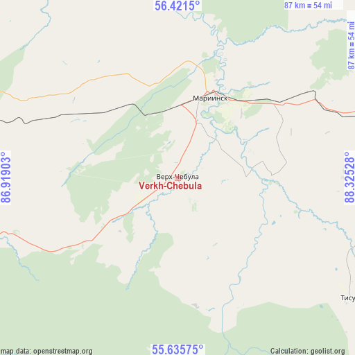
Verkh-Chebula GPS coordinates[2]
56° 1' 50.232" North, 87° 37' 19.74" East
| Map corner | latitude | longitude |
|---|---|---|
| Upper-left | 56.4215°, | 86.91903° |
| Center: | 56.03062°, | 87.62215° |
| Lower-right: | 55.63575°, | 88.32528° |
| Map W x H: | 87.4×87.4 km | = 54.3×54.3mi |
| max Lat: | 73.50819° ⇑33% North |
| Verkh-Chebula: | 56.03062° |
| min Lat: | ⇓67% South 41.28413° |
| min Long | Verkh-Chebula | max Long |
| -179.12198° | 87.62215° | 179.35046° |
| W 84.9%⇐ | ⇒15.1% E |
Elevation
Elevation of Verkh-Chebula is 155 m = 509 ft, and this is 47.6 m = 156 ft below average elevation for this country.
| Max E: |
2518 m = 8261 ft | 45.5% |
| Avg. | 202.6 m = 665 ft | |
| Verkh-Chebula | 155 m = 509 ft | |
Min E: |
-28 m = -92 ft | 54.5% |
See also: Russia elevation on elevation.city.
Geographical zone
Verkh-Chebula is located in North temperate zone (between Tropic of Cancer and the Arctic Circle). Distance of this North polar circle is 1171.2 km =727.7 mi to North.| Distance of | km | miles | from Verkh-Chebula |
|---|---|---|---|
| North Pole | 3777 | 2346.9 | to North |
| Arctic Circle | 1171.2 | 727.7 | to North |
| Tropic Cancer | 3624.1 | 2251.9 | to South |
| Equator | 6230 | 3871.1 | to South |


Nearby cities:
15 places around Verkh-Chebula: (largest is in red/bold)
• Anzhero-Sudzhensk
99.1 km =61.6 mi,  273°
273°
• Barzas
87.7 km =54.5 mi,  247°
247°
• Berëzovskiy
100.9 km =62.7 mi,  241°
241°
• Dubinino
102.5 km =63.7 mi,  116°
116°
• Goryachegorsk
107 km =66.5 mi,  130°
130°
• Itatskiy
88 km =54.7 mi,  87°
87°
• Izhmorskiy
63.4 km =39.4 mi,  286°
286°
• Mariinsk
21.8 km =13.5 mi,  20°
20°
• Promyshlennovskiy
107.8 km =67 mi, 235°
• Rudnichnyy
85.4 km =53.1 mi, 274°
• Suslovo
37 km =23 mi,  55°
55°
• Tisul’
52.4 km =32.6 mi, 124°
• Tyazhinskiy
56.7 km =35.2 mi,  80°
80°
• Yaya
75.8 km =47.1 mi,  284°
284°
• Zyryanskoye
107.9 km =67 mi,  325°
325°
Sources, notices
• [Note1] Compared only with cities in Russia existing in our database
• [Src1] Map data: © OpenStreetMap contributors (CC-BY-SA)
• [Src2] Other city data from geonames.org with taken over terms of usage.
• [Src3] Geographical zone / Annual Mean Temperature by Robert A. Rohde @ Wikipedia
