Mariinsk geodata
Mariinsk (Kemerovo Oblast) is a populated place; located in Russia in Asia/Novokuznetsk (GMT+7) time zone. With population of 43,122 people, there are 486 cities with bigger population in this country. Compared to other cities in Russia, 69.5% of cities are located further ↓South; 85% of cities are located further ←West and 56.2% of cities have higher elevation than Mariinsk. Note1


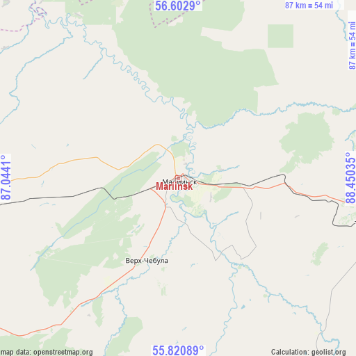
Mariinsk GPS coordinates[2]
56° 12' 50.004" North, 87° 44' 49.992" East
| Map corner | latitude | longitude |
|---|---|---|
| Upper-left | 56.6029°, | 87.0441° |
| Center: | 56.21389°, | 87.74722° |
| Lower-right: | 55.82089°, | 88.45035° |
| Map W x H: | 87×86.9 km | = 54.1×54mi |
| max Lat: | 73.50819° ⇑30.5% North |
| Mariinsk: | 56.21389° |
| min Lat: | ⇓69.5% South 41.28413° |
| min Long | Mariinsk | max Long |
| -179.12198° | 87.74722° | 179.35046° |
| W 85%⇐ | ⇒15% E |
Elevation
Elevation of Mariinsk is 132 m = 433 ft, and this is 70.6 m = 232 ft below average elevation for this country.
| Max E: |
2518 m = 8261 ft | 56.2% |
| Avg. | 202.6 m = 665 ft | |
| Mariinsk | 132 m = 433 ft | |
Min E: |
-28 m = -92 ft | 43.8% |
See also: Mariinsk elevation on elevation.city.
Geographical zone
Mariinsk is located in North temperate zone (between Tropic of Cancer and the Arctic Circle). Distance of this North polar circle is 1150.8 km =715.1 mi to North.| Distance of | km | miles | from Mariinsk |
|---|---|---|---|
| North Pole | 3756.7 | 2334.3 | to North |
| Arctic Circle | 1150.8 | 715.1 | to North |
| Tropic Cancer | 3644.5 | 2264.6 | to South |
| Equator | 6250.4 | 3883.8 | to South |


Nearby cities:
15 places around Mariinsk: (largest is in red/bold)
• Anzhero-Sudzhensk
107.5 km =66.8 mi,  262°
262°
• Barzas
103.8 km =64.5 mi,  238°
238°
• Bogotol
110.5 km =68.7 mi,  90°
90°
• Dubinino
106.7 km =66.3 mi,  128°
128°
• Goryachegorsk
116.1 km =72.1 mi,  141°
141°
• Itatskiy
81.5 km =50.6 mi,  101°
101°
• Izhmorskiy
68.4 km =42.5 mi,  267°
267°
• Rudnichnyy
93.8 km =58.3 mi, 261°
• Suslovo
22.8 km =14.2 mi, 89°
• Tisul’
61.3 km =38.1 mi,  145°
145°
• Tyazhinskiy
49.2 km =30.6 mi, 102°
• Tyukhtet
102.9 km =63.9 mi,  69°
69°
• Verkh-Chebula
21.8 km =13.5 mi,  200°
200°
• Yaya
80.8 km =50.2 mi, 269°
• Zyryanskoye
97.1 km =60.3 mi,  314°
314°
Sources, notices
• [Note1] Compared only with cities in Russia existing in our database
• [Src1] Map data: © OpenStreetMap contributors (CC-BY-SA)
• [Src2] Other city data from geonames.org with taken over terms of usage.
• [Src3] Geographical zone / Annual Mean Temperature by Robert A. Rohde @ Wikipedia
