Aleksandrovskoye geodata
Aleksandrovskoye (Tomsk Oblast) is a populated place; located in Russia in Asia/Tomsk (GMT+7) time zone. With population of 7,999 people, there are 1797 cities with bigger population in this country. Compared to other cities in Russia, 74.7% of cities are located further ↓South; 82.6% of cities are located further ←West and 51.9% of cities have lower elevation than Aleksandrovskoye. Note1


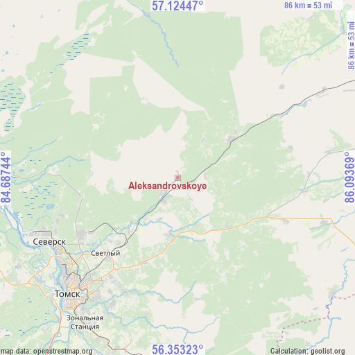
Aleksandrovskoye GPS coordinates[2]
56° 44' 26.988" North, 85° 23' 26.016" East
| Map corner | latitude | longitude |
|---|---|---|
| Upper-left | 57.12447°, | 84.68744° |
| Center: | 56.74083°, | 85.39056° |
| Lower-right: | 56.35323°, | 86.09369° |
| Map W x H: | 85.8×85.8 km | = 53.3×53.3mi |
| max Lat: | 73.50819° ⇑25.3% North |
| Aleksandrovskoye: | 56.74083° |
| min Lat: | ⇓74.7% South 41.28413° |
| min Long | Aleksandrovskoy | max Long |
| -179.12198° | 85.39056° | 179.35046° |
| W 82.6%⇐ | ⇒17.4% E |
Elevation
Elevation of Aleksandrovskoye is 149 m = 489 ft, and this is 53.6 m = 176 ft below average elevation for this country.
| Max E: |
2518 m = 8261 ft | 48.1% |
| Avg. | 202.6 m = 665 ft | |
| Aleksandrovskoye | 149 m = 489 ft | |
Min E: |
-28 m = -92 ft | 51.9% |
See also: Russia elevation on elevation.city.
Geographical zone
Aleksandrovskoye is located in North temperate zone (between Tropic of Cancer and the Arctic Circle). Distance of this North polar circle is 1092.2 km =678.7 mi to North.| Distance of | km | miles | from Aleksandrovskoye |
|---|---|---|---|
| North Pole | 3698.1 | 2297.9 | to North |
| Arctic Circle | 1092.2 | 678.7 | to North |
| Tropic Cancer | 3703.1 | 2301 | to South |
| Equator | 6309 | 3920.2 | to South |


Nearby cities:
15 places around Aleksandrovskoye: (largest is in red/bold)
• Anzhero-Sudzhensk
83.2 km =51.7 mi,  151°
151°
• Asino
54.1 km =33.6 mi,  57°
57°
• Bogashevo
44.1 km =27.4 mi,  200°
200°
• Kaltay
60.2 km =37.4 mi,  211°
211°
• Krasnyy Yar
67.6 km =42 mi,  309°
309°
• Mel’nikovo
82.5 km =51.3 mi,  255°
255°
• Moryakovskiy Zaton
45.4 km =28.2 mi, 263°
• Pervomayskoye
63.2 km =39.3 mi,  53°
53°
• Samus’
41.9 km =26 mi,  270°
270°
• Seversk
34.5 km =21.4 mi,  243°
243°
• Svetlyy
40.1 km =24.9 mi, 60°
• Tayga
76.6 km =47.6 mi,  169°
169°
• Timiryazevskoye
42 km =26.1 mi,  228°
228°
• Tomsk
37.1 km =23.1 mi,  223°
223°
• Zyryanskoye
76 km =47.2 mi,  82°
82°
Sources, notices
• [Note1] Compared only with cities in Russia existing in our database
• [Src1] Map data: © OpenStreetMap contributors (CC-BY-SA)
• [Src2] Other city data from geonames.org with taken over terms of usage.
• [Src3] Geographical zone / Annual Mean Temperature by Robert A. Rohde @ Wikipedia
