Priob’ye geodata
Priob’ye (Khanty-Mansia) is a populated place; located in Russia in Asia/Yekaterinburg (GMT+5) time zone. With population of 7,400 people, there are 1913 cities with bigger population in this country. Compared to other cities in Russia, 95.6% of cities are located further ↓South; 76.1% of cities are located further ←West and 97.8% of cities have higher elevation than Priob’ye. Note1


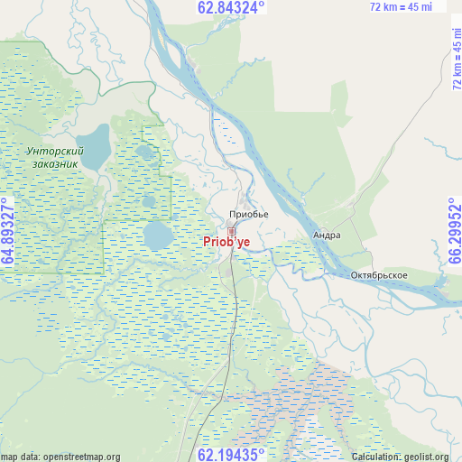
Priob’ye GPS coordinates[2]
62° 31' 14.016" North, 65° 35' 47.004" East
| Map corner | latitude | longitude |
|---|---|---|
| Upper-left | 62.84324°, | 64.89327° |
| Center: | 62.52056°, | 65.59639° |
| Lower-right: | 62.19435°, | 66.29952° |
| Map W x H: | 72.1×72.1 km | = 44.8×44.8mi |
| max Lat: | 73.50819° ⇑4.4% North |
| Priob’ye: | 62.52056° |
| min Lat: | ⇓95.6% South 41.28413° |
| min Long | Priob’ye | max Long |
| -179.12198° | 65.59639° | 179.35046° |
| W 76.1%⇐ | ⇒23.9% E |
Elevation
Elevation of Priob’ye is 5 m = 16 ft, and this is 197.6 m = 648 ft below average elevation for this country.
| Max E: |
2518 m = 8261 ft | 97.8% |
| Avg. | 202.6 m = 665 ft | |
| Priob’ye | 5 m = 16 ft | |
Min E: |
-28 m = -92 ft | 2.2% |
See also: Russia elevation on elevation.city.
Geographical zone
Priob’ye is located in North temperate zone (between Tropic of Cancer and the Arctic Circle). Distance of this North polar circle is 449.5 km =279.3 mi to North.| Distance of | km | miles | from Priob’ye |
|---|---|---|---|
| North Pole | 3055.4 | 1898.5 | to North |
| Arctic Circle | 449.5 | 279.3 | to North |
| Tropic Cancer | 4345.7 | 2700.3 | to South |
| Equator | 6951.6 | 4319.5 | to South |


Nearby cities:
15 places around Priob’ye: (largest is in red/bold)
• Agirish
148.9 km =92.5 mi,  243°
243°
• Andra
15 km =9.3 mi,  92°
92°
• Beloyarskiy
143.1 km =88.9 mi,  22°
22°
• Berëzovo
160 km =99.4 mi,  350°
350°
• Igrim
95.6 km =59.4 mi,  321°
321°
• Khanty-Mansiysk
246 km =152.9 mi,  133°
133°
• Khulimsunt
205.2 km =127.5 mi,  280°
280°
• Kommunisticheskiy
110.1 km =68.4 mi,  211°
211°
• Malinovskiy
206.4 km =128.3 mi,  224°
224°
• Nyagan
43.5 km =27 mi,  193°
193°
• Pionerskiy
205.4 km =127.6 mi, 224°
• Sherkaly
27.1 km =16.8 mi, 346°
• Sovetskiy
166.4 km =103.4 mi, 219°
• Yugorsk
179.2 km =111.3 mi, 221°
• Zelenoborsk
142.1 km =88.3 mi, 214°
Sources, notices
• [Note1] Compared only with cities in Russia existing in our database
• [Src1] Map data: © OpenStreetMap contributors (CC-BY-SA)
• [Src2] Other city data from geonames.org with taken over terms of usage.
• [Src3] Geographical zone / Annual Mean Temperature by Robert A. Rohde @ Wikipedia
