Malinovskiy geodata
Malinovskiy (Khanty-Mansia) is a populated place; located in Russia in Asia/Yekaterinburg (GMT+5) time zone. With population of 2,672 people, there are 3899 cities with bigger population in this country. Compared to other cities in Russia, 93.4% of cities are located further ↓South; 74.8% of cities are located further ←West and 72.9% of cities have higher elevation than Malinovskiy. Note1


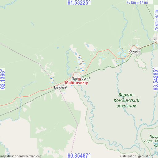
Malinovskiy GPS coordinates[2]
61° 11' 43.008" North, 62° 50' 22.992" East
| Map corner | latitude | longitude |
|---|---|---|
| Upper-left | 61.53225°, | 62.1366° |
| Center: | 61.19528°, | 62.83972° |
| Lower-right: | 60.85467°, | 63.54285° |
| Map W x H: | 75.3×75.3 km | = 46.8×46.8mi |
| max Lat: | 73.50819° ⇑6.6% North |
| Malinovskiy: | 61.19528° |
| min Lat: | ⇓93.4% South 41.28413° |
| min Long | Malinovskiy | max Long |
| -179.12198° | 62.83972° | 179.35046° |
| W 74.8%⇐ | ⇒25.2% E |
Elevation
Elevation of Malinovskiy is 94 m = 308 ft, and this is 108.6 m = 356 ft below average elevation for this country.
| Max E: |
2518 m = 8261 ft | 72.9% |
| Avg. | 202.6 m = 665 ft | |
| Malinovskiy | 94 m = 308 ft | |
Min E: |
-28 m = -92 ft | 27.1% |
See also: Russia elevation on elevation.city.
Geographical zone
Malinovskiy is located in North temperate zone (between Tropic of Cancer and the Arctic Circle). Distance of this North polar circle is 596.9 km =370.9 mi to North.| Distance of | km | miles | from Malinovskiy |
|---|---|---|---|
| North Pole | 3202.8 | 1990.1 | to North |
| Arctic Circle | 596.9 | 370.9 | to North |
| Tropic Cancer | 4198.4 | 2608.8 | to South |
| Equator | 6804.3 | 4228 | to South |


Nearby cities:
15 places around Malinovskiy: (largest is in red/bold)
• Agirish
81.7 km =50.8 mi,  6°
6°
• Cherëmukhovo
181.3 km =112.7 mi,  238°
238°
• Ivdel’
142.1 km =88.3 mi,  246°
246°
• Kommunisticheskiy
102.5 km =63.7 mi,  58°
58°
• Nyagan
170.9 km =106.2 mi,  52°
52°
• Ous
78 km =48.5 mi, 245°
• Pelym
49.7 km =30.9 mi, 245°
• Pionerskiy
1.6 km =1 mi,  92°
92°
• Polunochnoye
135.5 km =84.2 mi, 254°
• Severoural’sk
195.3 km =121.4 mi,  233°
233°
• Sovetskiy
43.9 km =27.3 mi,  65°
65°
• Tretiy Severnyy
191.2 km =118.8 mi, 234°
• Uray
159 km =98.8 mi,  138°
138°
• Yugorsk
29.3 km =18.2 mi, 63°
• Zelenoborsk
71.1 km =44.2 mi, 64°
Sources, notices
• [Note1] Compared only with cities in Russia existing in our database
• [Src1] Map data: © OpenStreetMap contributors (CC-BY-SA)
• [Src2] Other city data from geonames.org with taken over terms of usage.
• [Src3] Geographical zone / Annual Mean Temperature by Robert A. Rohde @ Wikipedia
