Şafwá geodata
Şafwá (Eastern Province) is a populated place; located in Saudi Arabia in Asia/Riyadh (GMT+3) time zone. With population of 45,876 people, there are 38 cities with bigger population in this country. Compared to other cities in Saudi Arabia, 81.4% of cities are located further ↓South; 90.7% of cities are located further ←West and 83.5% of cities have higher elevation than Şafwá. Note1


Şafwá GPS coordinates[2]
26° 38' 58.92" North, 49° 57' 18.792" East
| Map corner | latitude | longitude |
|---|---|---|
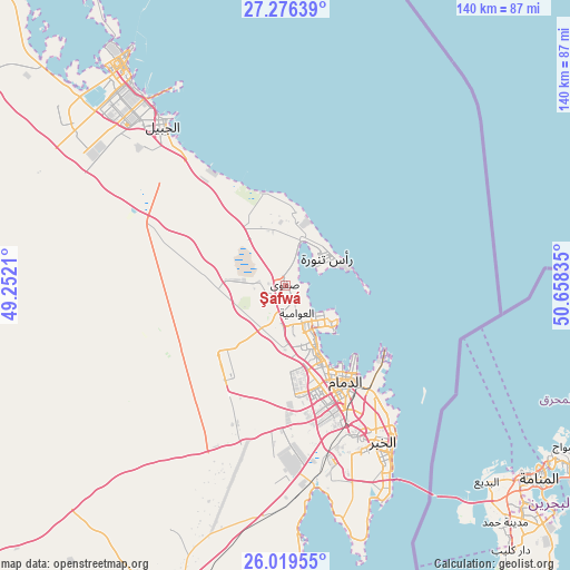
| Upper-left | 27.27639°, | 49.2521° |
| Center: | 26.6497°, | 49.95522° |
| Lower-right: | 26.01955°, | 50.65835° |
| Map W x H: | 139.7×139.7 km | = 86.8×86.8mi |
| max Lat: | 31.67252° ⇑18.6% North |
| Şafwá: | 26.6497° |
| min Lat: | ⇓81.4% South 16.57946° |
| min Long | Şafwá | max Long |
| 35.69014° | 49.95522° | 54.09599° |
| W 90.7%⇐ | ⇒9.3% E |
Elevation
Elevation of Şafwá is 18 m = 59 ft, and this is 503.4 m = 1652 ft below average elevation for this country.
| Max E: |
2385 m = 7825 ft | 83.5% |
| Avg. | 521.4 m = 1711 ft | |
| Şafwá | 18 m = 59 ft | |
Min E: |
3 m = 10 ft | 16.5% |
See also: Şafwá elevation on elevation.city.
Geographical zone
Şafwá is located in North temperate zone (between Tropic of Cancer and the Arctic Circle). Distance of this Northern Tropic circle is 357.2 km =222 mi to South.| Distance of | km | miles | from Şafwá |
|---|---|---|---|
| North Pole | 7043.9 | 4376.9 | to North |
| Arctic Circle | 4438 | 2757.6 | to North |
| Tropic Cancer | 357.2 | 222 | to South |
| Equator | 2963.2 | 1841.2 | to South |


Nearby cities:
15 places around Şafwá: (largest is in red/bold)
• Abqaiq
84.5 km =52.5 mi,  199°
199°
• Al Awjām
9.7 km =6 mi,  187°
187°
• Al Jubayl
52.5 km =32.6 mi,  321°
321°
• Al Muţayrifī
136.1 km =84.6 mi, 196°
• Al Qaţīf
10.8 km =6.7 mi,  150°
150°
• Al Qurayn
134.5 km =83.6 mi, 195°
• At Tūbī
10.8 km =6.7 mi,  160°
160°
• Dammam
28.1 km =17.5 mi, 148°
• Dhahran
43.1 km =26.8 mi, 158°
• Julayjilah
132.7 km =82.5 mi, 195°
• Khobar
48.3 km =30 mi, 148°
• Raḩīmah
12.4 km =7.7 mi,  58°
58°
• Sayhāt
20.7 km =12.9 mi, 153°
• Tārūt
12 km =7.5 mi,  135°
135°
• Umm as Sāhik
3.9 km =2.4 mi,  276°
276°
Sources, notices
• [Note1] Compared only with cities in Saudi Arabia existing in our database
• [Src1] Map data: © OpenStreetMap contributors (CC-BY-SA)
• [Src2] Other city data from geonames.org with taken over terms of usage.
• [Src3] Geographical zone / Annual Mean Temperature by Robert A. Rohde @ Wikipedia
