Al Awjām geodata
Al Awjām (Eastern Province) is a populated place; located in Saudi Arabia in Asia/Riyadh (GMT+3) time zone. With population of 11,460 people, there are 67 cities with bigger population in this country. Compared to other cities in Saudi Arabia, 77.3% of cities are located further ↓South; 89.7% of cities are located further ←West and 85.6% of cities have higher elevation than Al Awjām. Note1


Al Awjām GPS coordinates[2]
26° 33' 47.664" North, 49° 56' 35.916" East
| Map corner | latitude | longitude |
|---|---|---|
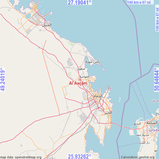
| Upper-left | 27.19041°, | 49.24019° |
| Center: | 26.56324°, | 49.94331° |
| Lower-right: | 25.93262°, | 50.64644° |
| Map W x H: | 139.9×139.9 km | = 86.9×86.9mi |
| max Lat: | 31.67252° ⇑22.7% North |
| Al Awjām: | 26.56324° |
| min Lat: | ⇓77.3% South 16.57946° |
| min Long | Al Awjām | max Long |
| 35.69014° | 49.94331° | 54.09599° |
| W 89.7%⇐ | ⇒10.3% E |
Elevation
Elevation of Al Awjām is 14 m = 46 ft, and this is 507.4 m = 1665 ft below average elevation for this country.
| Max E: |
2385 m = 7825 ft | 85.6% |
| Avg. | 521.4 m = 1711 ft | |
| Al Awjām | 14 m = 46 ft | |
Min E: |
3 m = 10 ft | 14.4% |
See also: Saudi Arabia elevation on elevation.city.
Geographical zone
Al Awjām is located in North temperate zone (between Tropic of Cancer and the Arctic Circle). Distance of this Northern Tropic circle is 347.6 km =216 mi to South.| Distance of | km | miles | from Al Awjām |
|---|---|---|---|
| North Pole | 7053.5 | 4382.8 | to North |
| Arctic Circle | 4447.6 | 2763.6 | to North |
| Tropic Cancer | 347.6 | 216 | to South |
| Equator | 2953.6 | 1835.3 | to South |


Nearby cities:
15 places around Al Awjām: (largest is in red/bold)
• Abqaiq
75.1 km =46.7 mi,  201°
201°
• Al Jubayl
59.7 km =37.1 mi,  327°
327°
• Al Muţayrifī
126.6 km =78.7 mi, 197°
• Al Qaţīf
6.5 km =4 mi,  87°
87°
• Al Qurayn
124.9 km =77.6 mi, 195°
• At Tūbī
4.8 km =3 mi,  97°
97°
• Dammam
21.4 km =13.3 mi,  131°
131°
• Dhahran
34.9 km =21.7 mi,  150°
150°
• Julayjilah
123.1 km =76.5 mi, 196°
• Khobar
41.1 km =25.5 mi,  140°
140°
• Raḩīmah
19.9 km =12.4 mi,  36°
36°
• Sayhāt
13.7 km =8.5 mi, 130°
• Tārūt
9.7 km =6 mi,  83°
83°
• Umm as Sāhik
10.4 km =6.5 mi,  345°
345°
• Şafwá
9.7 km =6 mi,  7°
7°
Sources, notices
• [Note1] Compared only with cities in Saudi Arabia existing in our database
• [Src1] Map data: © OpenStreetMap contributors (CC-BY-SA)
• [Src2] Other city data from geonames.org with taken over terms of usage.
• [Src3] Geographical zone / Annual Mean Temperature by Robert A. Rohde @ Wikipedia
