Al Jubayl geodata
Al Jubayl (Eastern Province) is a populated place; located in Saudi Arabia in Asia/Riyadh (GMT+3) time zone. With population of 237,274 people, there are 16 cities with bigger population in this country. Compared to other cities in Saudi Arabia, 84.5% of cities are located further ↓South; 79.4% of cities are located further ←West and 94.8% of cities have higher elevation than Al Jubayl. Note1


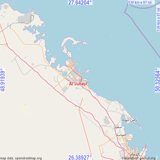
Al Jubayl GPS coordinates[2]
27° 1' 2.64" North, 49° 37' 21.036" East
| Map corner | latitude | longitude |
|---|---|---|
| Upper-left | 27.64204°, | 48.91939° |
| Center: | 27.0174°, | 49.62251° |
| Lower-right: | 26.38927°, | 50.32564° |
| Map W x H: | 139.3×139.3 km | = 86.6×86.6mi |
| max Lat: | 31.67252° ⇑15.5% North |
| Al Jubayl: | 27.0174° |
| min Lat: | ⇓84.5% South 16.57946° |
| min Long | Al Jubayl | max Long |
| 35.69014° | 49.62251° | 54.09599° |
| W 79.4%⇐ | ⇒20.6% E |
Elevation
Elevation of Al Jubayl is 5 m = 16 ft, and this is 516.4 m = 1694 ft below average elevation for this country.
| Max E: |
2385 m = 7825 ft | 94.8% |
| Avg. | 521.4 m = 1711 ft | |
| Al Jubayl | 5 m = 16 ft | |
Min E: |
3 m = 10 ft | 5.2% |
See also: Al Jubayl elevation on elevation.city.
Geographical zone
Al Jubayl is located in North temperate zone (between Tropic of Cancer and the Arctic Circle). Distance of this Northern Tropic circle is 398.1 km =247.4 mi to South.| Distance of | km | miles | from Al Jubayl |
|---|---|---|---|
| North Pole | 7003 | 4351.5 | to North |
| Arctic Circle | 4397.1 | 2732.2 | to North |
| Tropic Cancer | 398.1 | 247.4 | to South |
| Equator | 3004.1 | 1866.7 | to South |


Nearby cities:
15 places around Al Jubayl: (largest is in red/bold)
• Abqaiq
120.5 km =74.9 mi,  177°
177°
• Al Awjām
59.7 km =37.1 mi,  147°
147°
• Al Qaţīf
63.2 km =39.3 mi,  142°
142°
• As Saffānīyah
137.8 km =85.6 mi,  320°
320°
• At Tūbī
62.9 km =39.1 mi, 144°
• Dammam
80.5 km =50 mi, 143°
• Dhahran
94.6 km =58.8 mi, 148°
• Julayjilah
168.7 km =104.8 mi, 180°
• Khobar
100.6 km =62.5 mi, 144°
• Mulayjah
121.9 km =75.7 mi,  283°
283°
• Raḩīmah
55.5 km =34.5 mi,  128°
128°
• Sayhāt
72.9 km =45.3 mi, 144°
• Tārūt
64.5 km =40.1 mi, 139°
• Umm as Sāhik
49.9 km =31 mi, 144°
• Şafwá
52.5 km =32.6 mi, 141°
Sources, notices
• [Note1] Compared only with cities in Saudi Arabia existing in our database
• [Src1] Map data: © OpenStreetMap contributors (CC-BY-SA)
• [Src2] Other city data from geonames.org with taken over terms of usage.
• [Src3] Geographical zone / Annual Mean Temperature by Robert A. Rohde @ Wikipedia
