Al Kharj geodata
Al Kharj (Ar Riyāḑ) is a populated place; located in Saudi Arabia in Asia/Riyadh (GMT+3) time zone. With population of 425,300 people, there are 8 cities with bigger population in this country. Compared to other cities in Saudi Arabia, 66% of cities are located further ↑North; 70.1% of cities are located further ←West and 51.5% of cities have lower elevation than Al Kharj. Note1


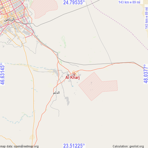
Al Kharj GPS coordinates[2]
24° 9' 19.476" North, 47° 20' 4.452" East
| Map corner | latitude | longitude |
|---|---|---|
| Upper-left | 24.79535°, | 46.63145° |
| Center: | 24.15541°, | 47.33457° |
| Lower-right: | 23.51225°, | 48.0377° |
| Map W x H: | 142.7×142.7 km | = 88.7×88.7mi |
| max Lat: | 31.67252° ⇑66% North |
| Al Kharj: | 24.15541° |
| min Lat: | ⇓34% South 16.57946° |
| min Long | Al Kharj | max Long |
| 35.69014° | 47.33457° | 54.09599° |
| W 70.1%⇐ | ⇒29.9% E |
Elevation
Elevation of Al Kharj is 438 m = 1437 ft, and this is 83.4 m = 274 ft below average elevation for this country.
| Max E: |
2385 m = 7825 ft | 48.5% |
| Avg. | 521.4 m = 1711 ft | |
| Al Kharj | 438 m = 1437 ft | |
Min E: |
3 m = 10 ft | 51.5% |
See also: Al Kharj elevation on elevation.city.
Geographical zone
Al Kharj is located in North temperate zone (between Tropic of Cancer and the Arctic Circle). Distance of this Northern Tropic circle is 79.9 km =49.6 mi to South.| Distance of | km | miles | from Al Kharj |
|---|---|---|---|
| North Pole | 7321.2 | 4549.2 | to North |
| Arctic Circle | 4715.3 | 2930 | to North |
| Tropic Cancer | 79.9 | 49.6 | to South |
| Equator | 2685.8 | 1668.9 | to South |


Nearby cities:
15 places around Al Kharj: (largest is in red/bold)
• Ad Dilam
25.3 km =15.7 mi,  223°
223°
• Al Baţţālīyah
272.1 km =169.1 mi,  58°
58°
• Al Hufūf
264.2 km =164.2 mi, 59°
• Al Jubayl
271.6 km =168.8 mi, 59°
• Al Mubarraz
266.9 km =165.8 mi, 58°
• Al Munayzilah
272.2 km =169.1 mi, 59°
• Al Muţayrifī
268.3 km =166.7 mi, 56°
• Al Qurayn
272.2 km =169.1 mi, 57°
• Al Qārah
274 km =170.3 mi, 59°
• Aţ Ţaraf
276.4 km =171.7 mi, 60°
• Julayjilah
273.1 km =169.7 mi, 56°
• Marāt
215.3 km =133.8 mi,  298°
298°
• Riyadh
85.7 km =53.3 mi,  313°
313°
• Tumayr
226.9 km =141 mi,  319°
319°
• shokhaibٍ
114.2 km =71 mi,  289°
289°
Sources, notices
• [Note1] Compared only with cities in Saudi Arabia existing in our database
• [Src1] Map data: © OpenStreetMap contributors (CC-BY-SA)
• [Src2] Other city data from geonames.org with taken over terms of usage.
• [Src3] Geographical zone / Annual Mean Temperature by Robert A. Rohde @ Wikipedia
