Ad Dilam geodata
Ad Dilam (Ar Riyāḑ) is a populated place; located in Saudi Arabia in Asia/Riyadh (GMT+3) time zone. With population of 35,371 people, there are 44 cities with bigger population in this country. Compared to other cities in Saudi Arabia, 68% of cities are located further ↑North; 69.1% of cities are located further ←West and 52.6% of cities have lower elevation than Ad Dilam. Note1


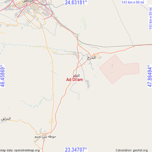
Ad Dilam GPS coordinates[2]
23° 59' 27.744" North, 47° 9' 42.516" East
| Map corner | latitude | longitude |
|---|---|---|
| Upper-left | 24.63181°, | 46.45869° |
| Center: | 23.99104°, | 47.16181° |
| Lower-right: | 23.34707°, | 47.86494° |
| Map W x H: | 142.8×142.9 km | = 88.7×88.8mi |
| max Lat: | 31.67252° ⇑68% North |
| Ad Dilam: | 23.99104° |
| min Lat: | ⇓32% South 16.57946° |
| min Long | Ad Dilam | max Long |
| 35.69014° | 47.16181° | 54.09599° |
| W 69.1%⇐ | ⇒30.9% E |
Elevation
Elevation of Ad Dilam is 453 m = 1486 ft, and this is 68.4 m = 224 ft below average elevation for this country.
| Max E: |
2385 m = 7825 ft | 47.4% |
| Avg. | 521.4 m = 1711 ft | |
| Ad Dilam | 453 m = 1486 ft | |
Min E: |
3 m = 10 ft | 52.6% |
See also: Saudi Arabia elevation on elevation.city.
Geographical zone
Ad Dilam is located in North temperate zone (between Tropic of Cancer and the Arctic Circle). Distance of this Northern Tropic circle is 61.6 km =38.3 mi to South.| Distance of | km | miles | from Ad Dilam |
|---|---|---|---|
| North Pole | 7339.5 | 4560.6 | to North |
| Arctic Circle | 4733.6 | 2941.3 | to North |
| Tropic Cancer | 61.6 | 38.3 | to South |
| Equator | 2667.6 | 1657.6 | to South |


Nearby cities:
15 places around Ad Dilam: (largest is in red/bold)
• Ad Dawādimī
286.6 km =178.1 mi,  281°
281°
• Al Baţţālīyah
296.7 km =184.4 mi,  57°
57°
• Al Hufūf
288.8 km =179.5 mi, 58°
• Al Jubayl
296.2 km =184.1 mi, 58°
• Al Kharj
25.3 km =15.7 mi,  43°
43°
• Al Majma‘ah
280.5 km =174.3 mi,  319°
319°
• Al Mubarraz
291.5 km =181.1 mi, 57°
• Al Munayzilah
296.6 km =184.3 mi, 58°
• Al Muţayrifī
293.1 km =182.1 mi, 55°
• Al Qurayn
296.9 km =184.5 mi, 56°
• Marāt
210 km =130.5 mi,  304°
304°
• Riyadh
89.4 km =55.6 mi,  330°
330°
• Sājir
291 km =180.8 mi, 297°
• Tumayr
230.8 km =143.4 mi, 325°
• shokhaibٍ
106.2 km =66 mi, 301°
Sources, notices
• [Note1] Compared only with cities in Saudi Arabia existing in our database
• [Src1] Map data: © OpenStreetMap contributors (CC-BY-SA)
• [Src2] Other city data from geonames.org with taken over terms of usage.
• [Src3] Geographical zone / Annual Mean Temperature by Robert A. Rohde @ Wikipedia
