Zalingei geodata
Zalingei (Central Darfur) is a seat of a first-order administrative division; located in Sudan in Africa/Khartoum (GMT+2) time zone. With population of 28,687 people, there are 30 cities with bigger population in this country. Compared to other cities in Sudan, 71.8% of cities are located further ↑North; 98.6% of cities are located further →East and 98.6% of cities have lower elevation than Zalingei. Note1


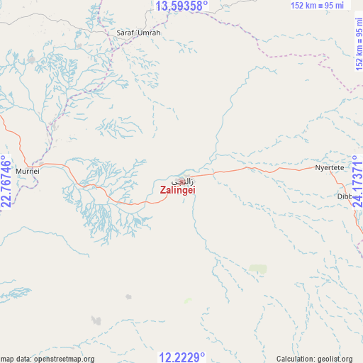
Zalingei GPS coordinates[2]
12° 54' 33.048" North, 23° 28' 14.088" East
| Map corner | latitude | longitude |
|---|---|---|
| Upper-left | 13.59358°, | 22.76746° |
| Center: | 12.90918°, | 23.47058° |
| Lower-right: | 12.2229°, | 24.17371° |
| Map W x H: | 152.4×152.4 km | = 94.7×94.7mi |
| max Lat: | 21.06667° ⇑71.8% North |
| Zalingei: | 12.90918° |
| min Lat: | ⇓28.2% South 10.55° |
| min Long | Zalingei | max Long |
| 22.44725° | 23.47058° | 37.729° |
| W 1.4%⇐ | ⇒98.6% E |
Elevation
Elevation of Zalingei is 891 m = 2923 ft, and this is 441.9 m = 1450 ft above average elevation for this country.
| Max E: |
1159 m = 3802 ft | 1.4% |
| Zalingei | 891 m 2923 ft | |
| Avg. | 449.1 m = 1473 ft | |
Min E: |
4 m = 13 ft | 98.6% |
See also: Sudan elevation on elevation.city.
Geographical zone
Zalingei is located in North Torrid zone (between Equator and Tropic of Cancer). Distance of this Northern Tropic circle is 1170.6 km =727.4 mi to North.| Distance of | km | miles | from Zalingei |
|---|---|---|---|
| North Pole | 8571.7 | 5326.2 | to North |
| Arctic Circle | 5965.8 | 3707 | to North |
| Tropic Cancer | 1170.6 | 727.4 | to North |
| Equator | 1435.4 | 891.9 | to South |


Nearby cities:
7 places around Zalingei: (largest is in red/bold)
• El Daein
330.4 km =205.3 mi,  119°
119°
• El Fasher
218.5 km =135.8 mi,  68°
68°
• Geneina
126.2 km =78.4 mi,  298°
298°
• Gereida
256.8 km =159.6 mi,  135°
135°
• Kutum
193.2 km =120 mi,  42°
42°
• Nyala
180.5 km =112.2 mi, 121°
• Umm Kaddadah
356.6 km =221.6 mi,  77°
77°
Sources, notices
• [Note1] Compared only with cities in Sudan existing in our database
• [Src1] Map data: © OpenStreetMap contributors (CC-BY-SA)
• [Src2] Other city data from geonames.org with taken over terms of usage.
• [Src3] Geographical zone / Annual Mean Temperature by Robert A. Rohde @ Wikipedia
