Nyala geodata
Nyala (Southern Darfur) is a seat of a first-order administrative division; located in Sudan in Africa/Khartoum (GMT+2) time zone. With population of 565,734 people, there are 2 cities with bigger population in this country. Compared to other cities in Sudan, 83.1% of cities are located further ↑North; 95.8% of cities are located further →East and 93% of cities have lower elevation than Nyala. Note1


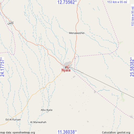
Nyala GPS coordinates[2]
12° 2' 55.968" North, 24° 52' 50.484" East
| Map corner | latitude | longitude |
|---|---|---|
| Upper-left | 12.73562°, | 24.17757° |
| Center: | 12.04888°, | 24.88069° |
| Lower-right: | 11.36038°, | 25.58382° |
| Map W x H: | 152.9×152.9 km | = 95×95mi |
| max Lat: | 21.06667° ⇑83.1% North |
| Nyala: | 12.04888° |
| min Lat: | ⇓16.9% South 10.55° |
| min Long | Nyala | max Long |
| 22.44725° | 24.88069° | 37.729° |
| W 4.2%⇐ | ⇒95.8% E |
Elevation
Elevation of Nyala is 661 m = 2169 ft, and this is 211.9 m = 695 ft above average elevation for this country.
| Max E: |
1159 m = 3802 ft | 7% |
| Nyala | 661 m 2169 ft | |
| Avg. | 449.1 m = 1473 ft | |
Min E: |
4 m = 13 ft | 93% |
See also: Nyala elevation on elevation.city.
Geographical zone
Nyala is located in North Torrid zone (between Equator and Tropic of Cancer). Distance of this Northern Tropic circle is 1266.2 km =786.8 mi to North.| Distance of | km | miles | from Nyala |
|---|---|---|---|
| North Pole | 8667.4 | 5385.7 | to North |
| Arctic Circle | 6061.5 | 3766.4 | to North |
| Tropic Cancer | 1266.2 | 786.8 | to North |
| Equator | 1339.7 | 832.5 | to South |


Nearby cities:
11 places around Nyala: (largest is in red/bold)
• Al Fūlah
380 km =236.1 mi,  95°
95°
• Al Mijlad
330.6 km =205.4 mi,  109°
109°
• An Nuhūd
392.6 km =244 mi,  79°
79°
• El Daein
150.4 km =93.5 mi,  115°
115°
• El Fasher
182.8 km =113.6 mi,  16°
16°
• El Fula
378.9 km =235.4 mi, 95°
• Geneina
306.6 km =190.5 mi,  300°
300°
• Gereida
90.5 km =56.2 mi,  161°
161°
• Kutum
240.3 km =149.3 mi,  354°
354°
• Umm Kaddadah
261.1 km =162.2 mi,  48°
48°
• Zalingei
180.5 km =112.2 mi, 301°
Sources, notices
• [Note1] Compared only with cities in Sudan existing in our database
• [Src1] Map data: © OpenStreetMap contributors (CC-BY-SA)
• [Src2] Other city data from geonames.org with taken over terms of usage.
• [Src3] Geographical zone / Annual Mean Temperature by Robert A. Rohde @ Wikipedia
