Vissefjärda geodata
Vissefjärda (Kalmar) is a populated place; located in Sweden in Europe/Stockholm (GMT+2) time zone. With population of 658 people, there are 1111 cities with bigger population in this country. Compared to other cities in Sweden, 83.6% of cities are located further ↑North; 56.6% of cities are located further ←West and 74.5% of cities have lower elevation than Vissefjärda. Note1


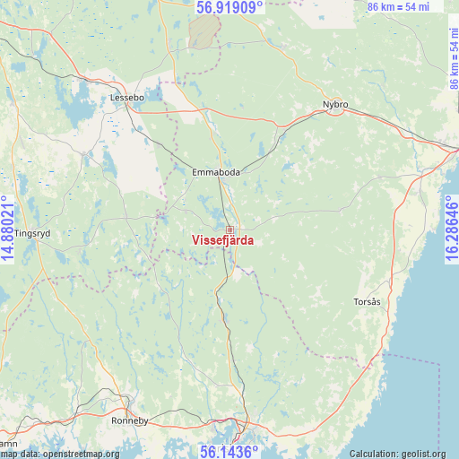
Vissefjärda GPS coordinates[2]
56° 31' 59.988" North, 15° 34' 59.988" East
| Map corner | latitude | longitude |
|---|---|---|
| Upper-left | 56.91909°, | 14.88021° |
| Center: | 56.53333°, | 15.58333° |
| Lower-right: | 56.1436°, | 16.28646° |
| Map W x H: | 86.2×86.2 km | = 53.6×53.6mi |
| max Lat: | 67.85572° ⇑83.6% North |
| Vissefjärda: | 56.53333° |
| min Lat: | ⇓16.4% South 55.34337° |
| min Long | Vissefjärda | max Long |
| 11.1712° | 15.58333° | 24.13676° |
| W 56.6%⇐ | ⇒43.4% E |
Elevation
Elevation of Vissefjärda is 117 m = 384 ft, and this is 34.4 m = 113 ft above average elevation for this country.
| Max E: |
663 m = 2175 ft | 25.5% |
| Vissefjärda | 117 m 384 ft | |
| Avg. | 82.6 m = 271 ft | |
Min E: |
-1 m = -3 ft | 74.5% |
See also: Sweden elevation on elevation.city.
Geographical zone
Vissefjärda is located in North temperate zone (between Tropic of Cancer and the Arctic Circle). Distance of this North polar circle is 1115.3 km =693 mi to North.| Distance of | km | miles | from Vissefjärda |
|---|---|---|---|
| North Pole | 3721.1 | 2312.2 | to North |
| Arctic Circle | 1115.3 | 693 | to North |
| Tropic Cancer | 3680 | 2286.6 | to South |
| Equator | 6285.9 | 3905.9 | to South |


Nearby cities:
15 places around Vissefjärda: (largest is in red/bold)
• Bergkvara
34 km =21.1 mi,  117°
117°
• Emmaboda
11.4 km =7.1 mi,  345°
345°
• Fridlevstad
29.1 km =18.1 mi,  185°
185°
• Kallinge
36.5 km =22.7 mi,  209°
209°
• Kosta
36.3 km =22.6 mi,  341°
341°
• Lessebo
31 km =19.3 mi,  321°
321°
• Nybro
30.7 km =19.1 mi,  40°
40°
• Orrefors
35.6 km =22.1 mi,  16°
16°
• Påryd
20.8 km =12.9 mi,  79°
79°
• Rödeby
30.4 km =18.9 mi,  175°
175°
• Skruv
20.7 km =12.9 mi, 320°
• Söderåkra
31.1 km =19.3 mi,  107°
107°
• Torsås
28.8 km =17.9 mi, 117°
• Tving
26.3 km =16.3 mi,  195°
195°
• Vassmolösa
36.5 km =22.7 mi, 78°
Sources, notices
• [Note1] Compared only with cities in Sweden existing in our database
• [Src1] Map data: © OpenStreetMap contributors (CC-BY-SA)
• [Src2] Other city data from geonames.org with taken over terms of usage.
• [Src3] Geographical zone / Annual Mean Temperature by Robert A. Rohde @ Wikipedia
