Vattjom geodata
Vattjom (Västernorrland) is a populated place; located in Sweden in Europe/Stockholm (GMT+2) time zone. With population of 563 people, there are 1215 cities with bigger population in this country. Compared to other cities in Sweden, 86.5% of cities are located further ↓South; 73.5% of cities are located further ←West and 84.8% of cities have lower elevation than Vattjom. Note1
Administrative division(s):
- Level 1: Västernorrland
- Level 2: Sundsvalls Kommun
- Level 3: Tuna
- Level 4: Tuna socken


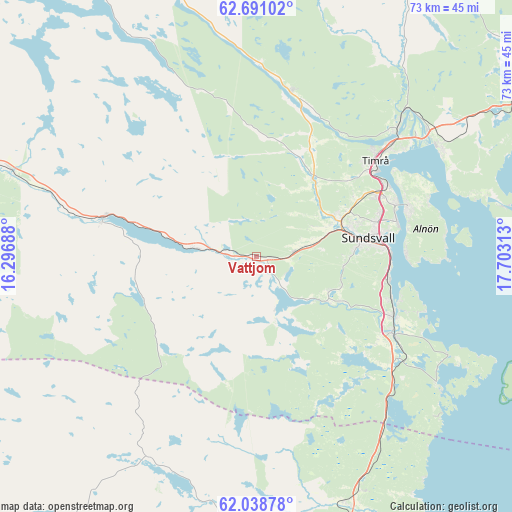
Vattjom GPS coordinates[2]
62° 22' 0.012" North, 17° 0' 0" East
| Map corner | latitude | longitude |
|---|---|---|
| Upper-left | 62.69102°, | 16.29688° |
| Center: | 62.36667°, | 17° |
| Lower-right: | 62.03878°, | 17.70313° |
| Map W x H: | 72.5×72.5 km | = 45×45mi |
| max Lat: | 67.85572° ⇑13.5% North |
| Vattjom: | 62.36667° |
| min Lat: | ⇓86.5% South 55.34337° |
| min Long | Vattjom | max Long |
| 11.1712° | 17° | 24.13676° |
| W 73.5%⇐ | ⇒26.5% E |
Elevation
Elevation of Vattjom is 167 m = 548 ft, and this is 84.4 m = 277 ft above average elevation for this country.
| Max E: |
663 m = 2175 ft | 15.2% |
| Vattjom | 167 m 548 ft | |
| Avg. | 82.6 m = 271 ft | |
Min E: |
-1 m = -3 ft | 84.8% |
See also: Sweden elevation on elevation.city.
Geographical zone
Vattjom is located in North temperate zone (between Tropic of Cancer and the Arctic Circle). Distance of this North polar circle is 466.7 km =290 mi to North.| Distance of | km | miles | from Vattjom |
|---|---|---|---|
| North Pole | 3072.5 | 1909.2 | to North |
| Arctic Circle | 466.7 | 290 | to North |
| Tropic Cancer | 4328.6 | 2689.7 | to South |
| Equator | 6934.5 | 4308.9 | to South |


Nearby cities:
15 places around Vattjom: (largest is in red/bold)
• Ankarsvik
21.2 km =13.2 mi,  88°
88°
• Essvik
21 km =13 mi,  105°
105°
• Högsjö
17.9 km =11.1 mi,  15°
15°
• Johannedal
20.6 km =12.8 mi,  68°
68°
• Klingsta
12.1 km =7.5 mi, 111°
• Kvissleby
21 km =13 mi, 112°
• Lucksta
7.9 km =4.9 mi,  161°
161°
• Matfors
2.6 km =1.6 mi,  140°
140°
• Nolby
21 km =13 mi, 114°
• Skottsund
21.7 km =13.5 mi, 112°
• Stockvik
19.2 km =11.9 mi,  100°
100°
• Sundsbruk
20.6 km =12.8 mi,  60°
60°
• Sundsvall
16 km =9.9 mi,  80°
80°
• Timrå
21.4 km =13.3 mi,  51°
51°
• Vi
11.4 km =7.1 mi,  130°
130°
Sources, notices
• [Note1] Compared only with cities in Sweden existing in our database
• [Src1] Map data: © OpenStreetMap contributors (CC-BY-SA)
• [Src2] Other city data from geonames.org with taken over terms of usage.
• [Src3] Geographical zone / Annual Mean Temperature by Robert A. Rohde @ Wikipedia
