Högsjö geodata
Högsjö (Västernorrland) is a populated place; located in Sweden in Europe/Stockholm (GMT+2) time zone. With population of 779 people, there are 982 cities with bigger population in this country. Compared to other cities in Sweden, 87.6% of cities are located further ↓South; 75.2% of cities are located further ←West and 78.3% of cities have lower elevation than Högsjö. Note1
Administrative division(s):
- Level 1: Västernorrland
- Level 2: Sundsvalls Kommun
- Level 3: Indal
- Level 4: Indal socken


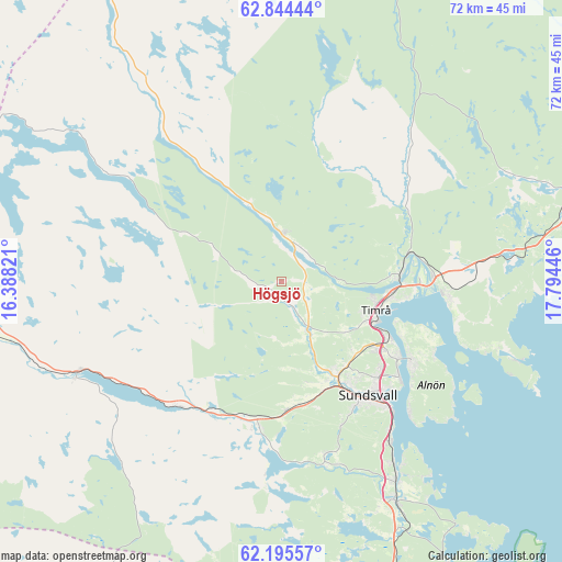
Högsjö GPS coordinates[2]
62° 31' 18.372" North, 17° 5' 28.788" East
| Map corner | latitude | longitude |
|---|---|---|
| Upper-left | 62.84444°, | 16.38821° |
| Center: | 62.52177°, | 17.09133° |
| Lower-right: | 62.19557°, | 17.79446° |
| Map W x H: | 72.1×72.1 km | = 44.8×44.8mi |
| max Lat: | 67.85572° ⇑12.4% North |
| Högsjö: | 62.52177° |
| min Lat: | ⇓87.6% South 55.34337° |
| min Long | Högsjö | max Long |
| 11.1712° | 17.09133° | 24.13676° |
| W 75.2%⇐ | ⇒24.8% E |
Elevation
Elevation of Högsjö is 136 m = 446 ft, and this is 53.4 m = 175 ft above average elevation for this country.
| Max E: |
663 m = 2175 ft | 21.7% |
| Högsjö | 136 m 446 ft | |
| Avg. | 82.6 m = 271 ft | |
Min E: |
-1 m = -3 ft | 78.3% |
See also: Sweden elevation on elevation.city.
Geographical zone
Högsjö is located in North temperate zone (between Tropic of Cancer and the Arctic Circle). Distance of this North polar circle is 449.4 km =279.2 mi to North.| Distance of | km | miles | from Högsjö |
|---|---|---|---|
| North Pole | 3055.3 | 1898.5 | to North |
| Arctic Circle | 449.4 | 279.2 | to North |
| Tropic Cancer | 4345.9 | 2700.4 | to South |
| Equator | 6951.8 | 4319.6 | to South |


Nearby cities:
15 places around Högsjö: (largest is in red/bold)
• Ankarsvik
23.6 km =14.7 mi,  135°
135°
• Bergeforsen
14.9 km =9.3 mi,  86°
86°
• Indal
6.2 km =3.9 mi,  3°
3°
• Johannedal
17.4 km =10.8 mi,  123°
123°
• Klingsta
22.6 km =14 mi,  163°
163°
• Lucksta
24.9 km =15.5 mi,  184°
184°
• Matfors
19.5 km =12.1 mi,  189°
189°
• Stockvik
25 km =15.5 mi,  145°
145°
• Sundsbruk
15 km =9.3 mi, 118°
• Sundsvall
18.2 km =11.3 mi, 142°
• Söråker
21.6 km =13.4 mi, 94°
• Timrå
12.7 km =7.9 mi,  108°
108°
• Vattjom
17.9 km =11.1 mi,  195°
195°
• Vi
19.4 km =12.1 mi, 120°
• Vi
25 km =15.5 mi,  171°
171°
Sources, notices
• [Note1] Compared only with cities in Sweden existing in our database
• [Src1] Map data: © OpenStreetMap contributors (CC-BY-SA)
• [Src2] Other city data from geonames.org with taken over terms of usage.
• [Src3] Geographical zone / Annual Mean Temperature by Robert A. Rohde @ Wikipedia
