Väjern geodata
Väjern (Västra Götaland) is a populated place; located in Sweden in Europe/Stockholm (GMT+2) time zone. With population of 659 people, there are 1110 cities with bigger population in this country. Compared to other cities in Sweden, 55% of cities are located further ↑North; 99.7% of cities are located further →East and 92.6% of cities have higher elevation than Väjern. Note1


Väjern GPS coordinates[2]
58° 22' 59.988" North, 11° 16' 0.012" East
| Map corner | latitude | longitude |
|---|---|---|
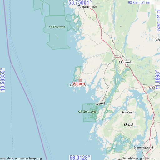
| Upper-left | 58.75001°, | 10.56355° |
| Center: | 58.38333°, | 11.26667° |
| Lower-right: | 58.0128°, | 11.9698° |
| Map W x H: | 82×82 km | = 51×51mi |
| max Lat: | 67.85572° ⇑55% North |
| Väjern: | 58.38333° |
| min Lat: | ⇓45% South 55.34337° |
| min Long | Väjern | max Long |
| 11.1712° | 11.26667° | 24.13676° |
| W 0.3%⇐ | ⇒99.7% E |
Elevation
Elevation of Väjern is 7 m = 23 ft, and this is 75.6 m = 248 ft below average elevation for this country.
| Max E: |
663 m = 2175 ft | 92.6% |
| Avg. | 82.6 m = 271 ft | |
| Väjern | 7 m = 23 ft | |
Min E: |
-1 m = -3 ft | 7.4% |
See also: Sweden elevation on elevation.city.
Geographical zone
Väjern is located in North temperate zone (between Tropic of Cancer and the Arctic Circle). Distance of this North polar circle is 909.6 km =565.2 mi to North.| Distance of | km | miles | from Väjern |
|---|---|---|---|
| North Pole | 3515.4 | 2184.4 | to North |
| Arctic Circle | 909.6 | 565.2 | to North |
| Tropic Cancer | 3885.7 | 2414.5 | to South |
| Equator | 6491.6 | 4033.7 | to South |


Nearby cities:
15 places around Väjern: (largest is in red/bold)
• Ammenäs
33.6 km =20.9 mi,  103°
103°
• Brastad
12.6 km =7.8 mi,  90°
90°
• Dingle
24.2 km =15 mi,  48°
48°
• Ellös
25.1 km =15.6 mi,  152°
152°
• Fjällbacka
24.1 km =15 mi,  2°
2°
• Grundsund
21 km =13 mi, 154°
• Hamburgsund
18.8 km =11.7 mi, 1°
• Henån
28.8 km =17.9 mi,  123°
123°
• Hunnebostrand
6.8 km =4.2 mi,  18°
18°
• Hällevadsholm
27 km =16.8 mi,  36°
36°
• Kungshamn
2.3 km =1.4 mi,  190°
190°
• Lysekil
15.6 km =9.7 mi,  140°
140°
• Munkedal
25.4 km =15.8 mi,  68°
68°
• Smögen
3.9 km =2.4 mi,  219°
219°
• Sunningen
33.5 km =20.8 mi, 99°
Sources, notices
• [Note1] Compared only with cities in Sweden existing in our database
• [Src1] Map data: © OpenStreetMap contributors (CC-BY-SA)
• [Src2] Other city data from geonames.org with taken over terms of usage.
• [Src3] Geographical zone / Annual Mean Temperature by Robert A. Rohde @ Wikipedia
