Munkedal geodata
Munkedal (Västra Götaland) is a seat of a second-order administrative division; located in Sweden in Europe/Stockholm (GMT+2) time zone. With population of 3,910 people, there are 330 cities with bigger population in this country. Compared to other cities in Sweden, 53.6% of cities are located further ↑North; 98.1% of cities are located further →East and 70.9% of cities have higher elevation than Munkedal. Note1
Administrative division(s):
- Level 1: Västra Götaland
- Level 2: Munkedals Kommun
- Level 3: Foss
- Level 4: Foss socken


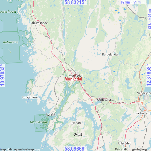
Munkedal GPS coordinates[2]
58° 27' 58.824" North, 11° 40' 24.42" East
| Map corner | latitude | longitude |
|---|---|---|
| Upper-left | 58.83215°, | 10.97033° |
| Center: | 58.46634°, | 11.67345° |
| Lower-right: | 58.09668°, | 12.37658° |
| Map W x H: | 81.8×81.8 km | = 50.8×50.8mi |
| max Lat: | 67.85572° ⇑53.6% North |
| Munkedal: | 58.46634° |
| min Lat: | ⇓46.4% South 55.34337° |
| min Long | Munkedal | max Long |
| 11.1712° | 11.67345° | 24.13676° |
| W 1.9%⇐ | ⇒98.1% E |
Elevation
Elevation of Munkedal is 24 m = 79 ft, and this is 58.6 m = 192 ft below average elevation for this country.
| Max E: |
663 m = 2175 ft | 70.9% |
| Avg. | 82.6 m = 271 ft | |
| Munkedal | 24 m = 79 ft | |
Min E: |
-1 m = -3 ft | 29.1% |
See also: Sweden elevation on elevation.city.
Geographical zone
Munkedal is located in North temperate zone (between Tropic of Cancer and the Arctic Circle). Distance of this North polar circle is 900.3 km =559.4 mi to North.| Distance of | km | miles | from Munkedal |
|---|---|---|---|
| North Pole | 3506.2 | 2178.7 | to North |
| Arctic Circle | 900.3 | 559.4 | to North |
| Tropic Cancer | 3894.9 | 2420.2 | to South |
| Equator | 6500.8 | 4039.4 | to South |


Nearby cities:
15 places around Munkedal: (largest is in red/bold)
• Ammenäs
19.2 km =11.9 mi,  152°
152°
• Brastad
14.4 km =8.9 mi,  230°
230°
• Dingle
8.8 km =5.5 mi,  320°
320°
• Fjällbacka
27.1 km =16.8 mi,  303°
303°
• Färgelanda
21.7 km =13.5 mi,  58°
58°
• Hamburgsund
25.2 km =15.7 mi,  292°
292°
• Henån
25.3 km =15.7 mi,  179°
179°
• Hunnebostrand
21.7 km =13.5 mi,  262°
262°
• Hällevadsholm
14.8 km =9.2 mi,  328°
328°
• Kungshamn
26.7 km =16.6 mi,  244°
244°
• Lysekil
25.5 km =15.8 mi,  212°
212°
• Sunningen
17.5 km =10.9 mi, 147°
• Uddevalla
20.5 km =12.7 mi,  130°
130°
• Väjern
25.4 km =15.8 mi,  248°
248°
• Ödeborg
19.6 km =12.2 mi, 63°
Sources, notices
• [Note1] Compared only with cities in Sweden existing in our database
• [Src1] Map data: © OpenStreetMap contributors (CC-BY-SA)
• [Src2] Other city data from geonames.org with taken over terms of usage.
• [Src3] Geographical zone / Annual Mean Temperature by Robert A. Rohde @ Wikipedia
