Urshult geodata
Urshult (Kronoberg) is a populated place; located in Sweden in Europe/Stockholm (GMT+2) time zone. With population of 942 people, there are 857 cities with bigger population in this country. Compared to other cities in Sweden, 83.6% of cities are located further ↑North; 53.7% of cities are located further →East and 80.4% of cities have lower elevation than Urshult. Note1


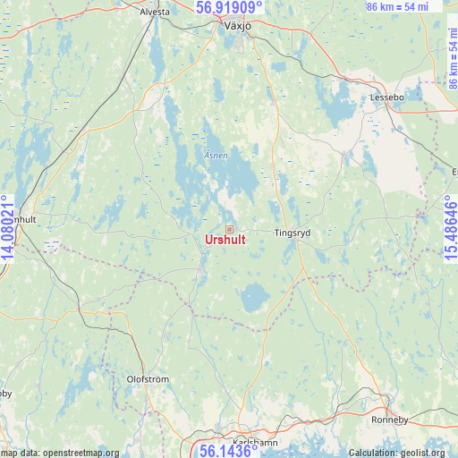
Urshult GPS coordinates[2]
56° 31' 59.988" North, 14° 46' 59.988" East
| Map corner | latitude | longitude |
|---|---|---|
| Upper-left | 56.91909°, | 14.08021° |
| Center: | 56.53333°, | 14.78333° |
| Lower-right: | 56.1436°, | 15.48646° |
| Map W x H: | 86.2×86.2 km | = 53.6×53.6mi |
| max Lat: | 67.85572° ⇑83.6% North |
| Urshult: | 56.53333° |
| min Lat: | ⇓16.4% South 55.34337° |
| min Long | Urshult | max Long |
| 11.1712° | 14.78333° | 24.13676° |
| W 46.3%⇐ | ⇒53.7% E |
Elevation
Elevation of Urshult is 147 m = 482 ft, and this is 64.4 m = 211 ft above average elevation for this country.
| Max E: |
663 m = 2175 ft | 19.6% |
| Urshult | 147 m 482 ft | |
| Avg. | 82.6 m = 271 ft | |
Min E: |
-1 m = -3 ft | 80.4% |
See also: Sweden elevation on elevation.city.
Geographical zone
Urshult is located in North temperate zone (between Tropic of Cancer and the Arctic Circle). Distance of this North polar circle is 1115.3 km =693 mi to North.| Distance of | km | miles | from Urshult |
|---|---|---|---|
| North Pole | 3721.1 | 2312.2 | to North |
| Arctic Circle | 1115.3 | 693 | to North |
| Tropic Cancer | 3680 | 2286.6 | to South |
| Equator | 6285.9 | 3905.9 | to South |


Nearby cities:
15 places around Urshult: (largest is in red/bold)
• Diö
36.4 km =22.6 mi,  287°
287°
• Grimslöv
27 km =16.8 mi,  325°
325°
• Hovmantorp
35.6 km =22.1 mi,  37°
37°
• Ingelstad
25.4 km =15.8 mi,  18°
18°
• Jämshög
37.2 km =23.1 mi,  206°
206°
• Kyrkhult
23.8 km =14.8 mi, 211°
• Liatorp
34.9 km =21.7 mi,  295°
295°
• Lönsboda
32.3 km =20.1 mi,  242°
242°
• Olofström
32.3 km =20.1 mi, 208°
• Ryd
9.6 km =6 mi,  219°
219°
• Svängsta
29.7 km =18.5 mi,  181°
181°
• Tingsryd
12 km =7.5 mi,  94°
94°
• Vislanda
34.5 km =21.4 mi,  323°
323°
• Väckelsång
13.8 km =8.6 mi, 36°
• Åryd
34.8 km =21.6 mi, 20°
Sources, notices
• [Note1] Compared only with cities in Sweden existing in our database
• [Src1] Map data: © OpenStreetMap contributors (CC-BY-SA)
• [Src2] Other city data from geonames.org with taken over terms of usage.
• [Src3] Geographical zone / Annual Mean Temperature by Robert A. Rohde @ Wikipedia
