Surte geodata
Surte (Västra Götaland) is a populated place; located in Sweden in Europe/Stockholm (GMT+2) time zone. With population of 6,003 people, there are 236 cities with bigger population in this country. Compared to other cities in Sweden, 63.5% of cities are located further ↑North; 94.6% of cities are located further →East and 91.5% of cities have higher elevation than Surte. Note1
Administrative division(s):
- Level 1: Västra Götaland
- Level 2: Ale Kommun
- Level 3: Nödinge
- Level 4: Nödinge socken


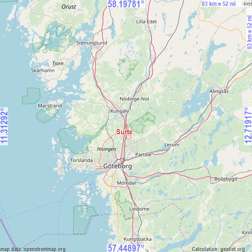
Surte GPS coordinates[2]
57° 49' 31.188" North, 12° 0' 57.744" East
| Map corner | latitude | longitude |
|---|---|---|
| Upper-left | 58.19781°, | 11.31292° |
| Center: | 57.82533°, | 12.01604° |
| Lower-right: | 57.44897°, | 12.71917° |
| Map W x H: | 83.3×83.3 km | = 51.8×51.8mi |
| max Lat: | 67.85572° ⇑63.5% North |
| Surte: | 57.82533° |
| min Lat: | ⇓36.5% South 55.34337° |
| min Long | Surte | max Long |
| 11.1712° | 12.01604° | 24.13676° |
| W 5.4%⇐ | ⇒94.6% E |
Elevation
Elevation of Surte is 8 m = 26 ft, and this is 74.6 m = 245 ft below average elevation for this country.
| Max E: |
663 m = 2175 ft | 91.5% |
| Avg. | 82.6 m = 271 ft | |
| Surte | 8 m = 26 ft | |
Min E: |
-1 m = -3 ft | 8.5% |
See also: Sweden elevation on elevation.city.
Geographical zone
Surte is located in North temperate zone (between Tropic of Cancer and the Arctic Circle). Distance of this North polar circle is 971.6 km =603.7 mi to North.| Distance of | km | miles | from Surte |
|---|---|---|---|
| North Pole | 3577.5 | 2223 | to North |
| Arctic Circle | 971.6 | 603.7 | to North |
| Tropic Cancer | 3823.7 | 2375.9 | to South |
| Equator | 6429.6 | 3995.2 | to South |


Nearby cities:
15 places around Surte: (largest is in red/bold)
• Alafors
11.8 km =7.3 mi,  18°
18°
• Angered
6.5 km =4 mi,  131°
131°
• Björlanda
12.6 km =7.8 mi,  238°
238°
• Diseröd
11.2 km =7 mi,  2°
2°
• Eriksbo
6.2 km =3.9 mi,  165°
165°
• Gårdsten
2.4 km =1.5 mi,  161°
161°
• Hammarkullen
5.1 km =3.2 mi, 166°
• Kungälv
5.5 km =3.4 mi,  337°
337°
• Kyrkobyn
6.5 km =4 mi, 244°
• Kåhög
11.6 km =7.2 mi,  135°
135°
• Lövgärdet
1.7 km =1.1 mi, 129°
• Nolvik
12.2 km =7.6 mi, 242°
• Olofstorp
9.5 km =5.9 mi,  104°
104°
• Partille
10.9 km =6.8 mi,  150°
150°
• Rannebergen
4.2 km =2.6 mi, 127°
Sources, notices
• [Note1] Compared only with cities in Sweden existing in our database
• [Src1] Map data: © OpenStreetMap contributors (CC-BY-SA)
• [Src2] Other city data from geonames.org with taken over terms of usage.
• [Src3] Geographical zone / Annual Mean Temperature by Robert A. Rohde @ Wikipedia
