Hammarkullen geodata
Hammarkullen (Västra Götaland) is a populated place; located in Sweden in Europe/Stockholm (GMT+2) time zone. With population of 7,914 people, there are 186 cities with bigger population in this country. Compared to other cities in Sweden, 65% of cities are located further ↑North; 94.3% of cities are located further →East and 67.4% of cities have lower elevation than Hammarkullen. Note1
Administrative division(s):
- Level 1: Västra Götaland
- Level 2: Göteborgs stad
- Level 3: Angered
- Level 4: Angered socken


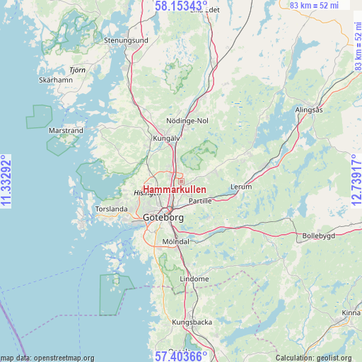
Hammarkullen GPS coordinates[2]
57° 46' 49.764" North, 12° 2' 9.744" East
| Map corner | latitude | longitude |
|---|---|---|
| Upper-left | 58.15343°, | 11.33292° |
| Center: | 57.78049°, | 12.03604° |
| Lower-right: | 57.40366°, | 12.73917° |
| Map W x H: | 83.4×83.4 km | = 51.8×51.8mi |
| max Lat: | 67.85572° ⇑65% North |
| Hammarkullen: | 57.78049° |
| min Lat: | ⇓35% South 55.34337° |
| min Long | Hammarkullen | max Long |
| 11.1712° | 12.03604° | 24.13676° |
| W 5.7%⇐ | ⇒94.3% E |
Elevation
Elevation of Hammarkullen is 91 m = 299 ft, and this is 8.4 m = 28 ft above average elevation for this country.
| Max E: |
663 m = 2175 ft | 32.6% |
| Hammarkullen | 91 m 299 ft | |
| Avg. | 82.6 m = 271 ft | |
Min E: |
-1 m = -3 ft | 67.4% |
See also: Sweden elevation on elevation.city.
Geographical zone
Hammarkullen is located in North temperate zone (between Tropic of Cancer and the Arctic Circle). Distance of this North polar circle is 976.6 km =606.8 mi to North.| Distance of | km | miles | from Hammarkullen |
|---|---|---|---|
| North Pole | 3582.5 | 2226.1 | to North |
| Arctic Circle | 976.6 | 606.8 | to North |
| Tropic Cancer | 3818.7 | 2372.8 | to South |
| Equator | 6424.6 | 3992.1 | to South |


Nearby cities:
15 places around Hammarkullen: (largest is in red/bold)
• Angered
3.8 km =2.4 mi,  80°
80°
• Eriksbo
1.1 km =0.7 mi,  161°
161°
• Furulund
9.1 km =5.7 mi,  140°
140°
• Gårdsten
2.7 km =1.7 mi,  351°
351°
• Göteborg
9.1 km =5.7 mi,  206°
206°
• Jonsered
9 km =5.6 mi,  115°
115°
• Kungälv
10.6 km =6.6 mi,  341°
341°
• Kyrkobyn
7.4 km =4.6 mi,  287°
287°
• Kåhög
7.6 km =4.7 mi, 115°
• Lövgärdet
3.9 km =2.4 mi,  2°
2°
• Olofstorp
8.4 km =5.2 mi,  71°
71°
• Partille
6.2 km =3.9 mi, 137°
• Rannebergen
3.2 km =2 mi,  40°
40°
• Surte
5.1 km =3.2 mi, 346°
• Öjersjö
10.8 km =6.7 mi,  147°
147°
Sources, notices
• [Note1] Compared only with cities in Sweden existing in our database
• [Src1] Map data: © OpenStreetMap contributors (CC-BY-SA)
• [Src2] Other city data from geonames.org with taken over terms of usage.
• [Src3] Geographical zone / Annual Mean Temperature by Robert A. Rohde @ Wikipedia
