Stenungsund geodata
Stenungsund (Västra Götaland) is a seat of a second-order administrative division; located in Sweden in Europe/Stockholm (GMT+2) time zone. With population of 13,093 people, there are 117 cities with bigger population in this country. Compared to other cities in Sweden, 59.5% of cities are located further ↑North; 96.8% of cities are located further →East and 93.9% of cities have higher elevation than Stenungsund. Note1


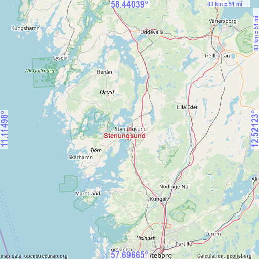
Stenungsund GPS coordinates[2]
58° 4' 13.656" North, 11° 49' 5.16" East
| Map corner | latitude | longitude |
|---|---|---|
| Upper-left | 58.44039°, | 11.11498° |
| Center: | 58.07046°, | 11.8181° |
| Lower-right: | 57.69665°, | 12.52123° |
| Map W x H: | 82.7×82.7 km | = 51.4×51.4mi |
| max Lat: | 67.85572° ⇑59.5% North |
| Stenungsund: | 58.07046° |
| min Lat: | ⇓40.5% South 55.34337° |
| min Long | Stenungsund | max Long |
| 11.1712° | 11.8181° | 24.13676° |
| W 3.2%⇐ | ⇒96.8% E |
Elevation
Elevation of Stenungsund is 6 m = 20 ft, and this is 76.6 m = 251 ft below average elevation for this country.
| Max E: |
663 m = 2175 ft | 93.9% |
| Avg. | 82.6 m = 271 ft | |
| Stenungsund | 6 m = 20 ft | |
Min E: |
-1 m = -3 ft | 6.1% |
See also: Sweden elevation on elevation.city.
Geographical zone
Stenungsund is located in North temperate zone (between Tropic of Cancer and the Arctic Circle). Distance of this North polar circle is 944.3 km =586.8 mi to North.| Distance of | km | miles | from Stenungsund |
|---|---|---|---|
| North Pole | 3550.2 | 2206 | to North |
| Arctic Circle | 944.3 | 586.8 | to North |
| Tropic Cancer | 3850.9 | 2392.8 | to South |
| Equator | 6456.8 | 4012.1 | to South |


Nearby cities:
15 places around Stenungsund: (largest is in red/bold)
• Aröd
11.5 km =7.1 mi,  189°
189°
• Höviksnäs
5.1 km =3.2 mi,  216°
216°
• Jörlanda
9.4 km =5.8 mi,  175°
175°
• Klövedal
14.4 km =8.9 mi,  253°
253°
• Kode
14.3 km =8.9 mi,  172°
172°
• Kyrkesund
18.7 km =11.6 mi, 251°
• Ljungskile
18.1 km =11.2 mi,  19°
19°
• Myggenäs
4.2 km =2.6 mi,  256°
256°
• Skärhamn
18 km =11.2 mi,  238°
238°
• Stora Höga
6 km =3.7 mi, 171°
• Svanesund
8.1 km =5 mi,  0°
0°
• Tjuvkil
19.6 km =12.2 mi, 194°
• Ucklum
7.9 km =4.9 mi,  79°
79°
• Varekil
8.7 km =5.4 mi,  311°
311°
• Ödsmål
3.8 km =2.4 mi,  29°
29°
Sources, notices
• [Note1] Compared only with cities in Sweden existing in our database
• [Src1] Map data: © OpenStreetMap contributors (CC-BY-SA)
• [Src2] Other city data from geonames.org with taken over terms of usage.
• [Src3] Geographical zone / Annual Mean Temperature by Robert A. Rohde @ Wikipedia
