Kode geodata
Kode (Västra Götaland) is a populated place; located in Sweden in Europe/Stockholm (GMT+2) time zone. With population of 1,605 people, there are 620 cities with bigger population in this country. Compared to other cities in Sweden, 61.5% of cities are located further ↑North; 96% of cities are located further →East and 67.8% of cities have higher elevation than Kode. Note1
Administrative division(s):
- Level 1: Västra Götaland
- Level 2: Kungälvs Kommun
- Level 3: Solberga
- Level 4: Solberga socken


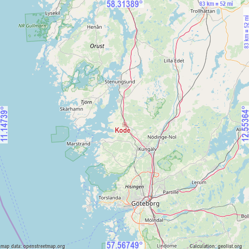
Kode GPS coordinates[2]
57° 56' 33.468" North, 11° 51' 1.836" East
| Map corner | latitude | longitude |
|---|---|---|
| Upper-left | 58.31389°, | 11.14739° |
| Center: | 57.94263°, | 11.85051° |
| Lower-right: | 57.56749°, | 12.55364° |
| Map W x H: | 83×83 km | = 51.6×51.6mi |
| max Lat: | 67.85572° ⇑61.5% North |
| Kode: | 57.94263° |
| min Lat: | ⇓38.5% South 55.34337° |
| min Long | Kode | max Long |
| 11.1712° | 11.85051° | 24.13676° |
| W 4%⇐ | ⇒96% E |
Elevation
Elevation of Kode is 27 m = 89 ft, and this is 55.6 m = 182 ft below average elevation for this country.
| Max E: |
663 m = 2175 ft | 67.8% |
| Avg. | 82.6 m = 271 ft | |
| Kode | 27 m = 89 ft | |
Min E: |
-1 m = -3 ft | 32.2% |
See also: Sweden elevation on elevation.city.
Geographical zone
Kode is located in North temperate zone (between Tropic of Cancer and the Arctic Circle). Distance of this North polar circle is 958.6 km =595.6 mi to North.| Distance of | km | miles | from Kode |
|---|---|---|---|
| North Pole | 3564.4 | 2214.8 | to North |
| Arctic Circle | 958.6 | 595.6 | to North |
| Tropic Cancer | 3836.7 | 2384 | to South |
| Equator | 6442.6 | 4003.2 | to South |


Nearby cities:
15 places around Kode: (largest is in red/bold)
• Alafors
13.6 km =8.5 mi,  97°
97°
• Aröd
4.8 km =3 mi,  306°
306°
• Diseröd
10.5 km =6.5 mi, 99°
• Höviksnäs
11.2 km =7 mi,  333°
333°
• Jörlanda
5 km =3.1 mi,  345°
345°
• Kungälv
11.1 km =6.9 mi,  136°
136°
• Kärna
11 km =6.8 mi,  201°
201°
• Myggenäs
14.5 km =9 mi,  335°
335°
• Rönnäng
15.8 km =9.8 mi,  266°
266°
• Stenungsund
14.3 km =8.9 mi, 352°
• Stora Höga
8.3 km =5.2 mi, 352°
• Surte
16.3 km =10.1 mi, 143°
• Tjuvkil
8.4 km =5.2 mi,  235°
235°
• Tollered
14.7 km =9.1 mi,  86°
86°
• Älvängen
16.2 km =10.1 mi,  83°
83°
Sources, notices
• [Note1] Compared only with cities in Sweden existing in our database
• [Src1] Map data: © OpenStreetMap contributors (CC-BY-SA)
• [Src2] Other city data from geonames.org with taken over terms of usage.
• [Src3] Geographical zone / Annual Mean Temperature by Robert A. Rohde @ Wikipedia
