Kyrkesund geodata
Kyrkesund (Västra Götaland) is a populated place; located in Sweden in Europe/Stockholm (GMT+2) time zone. With population of 547 people, there are 1239 cities with bigger population in this country. Compared to other cities in Sweden, 60.4% of cities are located further ↑North; 98.9% of cities are located further →East and 75.3% of cities have higher elevation than Kyrkesund. Note1


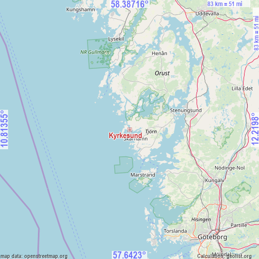
Kyrkesund GPS coordinates[2]
58° 1' 0.012" North, 11° 31' 0.012" East
| Map corner | latitude | longitude |
|---|---|---|
| Upper-left | 58.38716°, | 10.81355° |
| Center: | 58.01667°, | 11.51667° |
| Lower-right: | 57.6423°, | 12.2198° |
| Map W x H: | 82.8×82.8 km | = 51.4×51.4mi |
| max Lat: | 67.85572° ⇑60.4% North |
| Kyrkesund: | 58.01667° |
| min Lat: | ⇓39.6% South 55.34337° |
| min Long | Kyrkesund | max Long |
| 11.1712° | 11.51667° | 24.13676° |
| W 1.1%⇐ | ⇒98.9% E |
Elevation
Elevation of Kyrkesund is 20 m = 66 ft, and this is 62.6 m = 205 ft below average elevation for this country.
| Max E: |
663 m = 2175 ft | 75.3% |
| Avg. | 82.6 m = 271 ft | |
| Kyrkesund | 20 m = 66 ft | |
Min E: |
-1 m = -3 ft | 24.7% |
See also: Sweden elevation on elevation.city.
Geographical zone
Kyrkesund is located in North temperate zone (between Tropic of Cancer and the Arctic Circle). Distance of this North polar circle is 950.3 km =590.5 mi to North.| Distance of | km | miles | from Kyrkesund |
|---|---|---|---|
| North Pole | 3556.2 | 2209.7 | to North |
| Arctic Circle | 950.3 | 590.5 | to North |
| Tropic Cancer | 3844.9 | 2389.1 | to South |
| Equator | 6450.8 | 4008.3 | to South |


Nearby cities:
15 places around Kyrkesund: (largest is in red/bold)
• Aröd
16.7 km =10.4 mi,  108°
108°
• Ellös
18.8 km =11.7 mi,  350°
350°
• Grundsund
22.5 km =14 mi, 345°
• Höviksnäs
14.8 km =9.2 mi,  82°
82°
• Jörlanda
18.7 km =11.6 mi,  100°
100°
• Klövedal
4.3 km =2.7 mi,  64°
64°
• Kode
21.3 km =13.2 mi, 112°
• Myggenäs
14.6 km =9.1 mi,  69°
69°
• Rönnäng
10.1 km =6.3 mi,  157°
157°
• Skärhamn
4.1 km =2.5 mi,  144°
144°
• Stenungsund
18.7 km =11.6 mi, 71°
• Stora Höga
18.6 km =11.6 mi,  90°
90°
• Tjuvkil
18.2 km =11.3 mi, 135°
• Varekil
16.3 km =10.1 mi,  43°
43°
• Ödsmål
21.7 km =13.5 mi, 64°
Sources, notices
• [Note1] Compared only with cities in Sweden existing in our database
• [Src1] Map data: © OpenStreetMap contributors (CC-BY-SA)
• [Src2] Other city data from geonames.org with taken over terms of usage.
• [Src3] Geographical zone / Annual Mean Temperature by Robert A. Rohde @ Wikipedia
