Stenhamra geodata
Stenhamra (Stockholm) is a populated place; located in Sweden in Europe/Stockholm (GMT+2) time zone. With population of 3,588 people, there are 358 cities with bigger population in this country. Compared to other cities in Sweden, 61.6% of cities are located further ↓South; 81.4% of cities are located further ←West and 76.2% of cities have higher elevation than Stenhamra. Note1


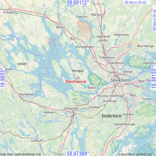
Stenhamra GPS coordinates[2]
59° 20' 3.84" North, 17° 41' 18.312" East
| Map corner | latitude | longitude |
|---|---|---|
| Upper-left | 59.69112°, | 16.9853° |
| Center: | 59.3344°, | 17.68842° |
| Lower-right: | 58.97389°, | 18.39155° |
| Map W x H: | 79.7×79.7 km | = 49.5×49.5mi |
| max Lat: | 67.85572° ⇑38.4% North |
| Stenhamra: | 59.3344° |
| min Lat: | ⇓61.6% South 55.34337° |
| min Long | Stenhamra | max Long |
| 11.1712° | 17.68842° | 24.13676° |
| W 81.4%⇐ | ⇒18.6% E |
Elevation
Elevation of Stenhamra is 19 m = 62 ft, and this is 63.6 m = 209 ft below average elevation for this country.
| Max E: |
663 m = 2175 ft | 76.2% |
| Avg. | 82.6 m = 271 ft | |
| Stenhamra | 19 m = 62 ft | |
Min E: |
-1 m = -3 ft | 23.8% |
See also: Sweden elevation on elevation.city.
Geographical zone
Stenhamra is located in North temperate zone (between Tropic of Cancer and the Arctic Circle). Distance of this North polar circle is 803.8 km =499.5 mi to North.| Distance of | km | miles | from Stenhamra |
|---|---|---|---|
| North Pole | 3409.7 | 2118.7 | to North |
| Arctic Circle | 803.8 | 499.5 | to North |
| Tropic Cancer | 3991.4 | 2480.1 | to South |
| Equator | 6597.4 | 4099.4 | to South |


Nearby cities:
15 places around Stenhamra: (largest is in red/bold)
• Alby
14.6 km =9.1 mi,  140°
140°
• Bromma
14.3 km =8.9 mi,  87°
87°
• Ekeby
13.4 km =8.3 mi,  225°
225°
• Ekerö
8.5 km =5.3 mi,  124°
124°
• Eriksberg
12.5 km =7.8 mi, 144°
• Fittja
13.6 km =8.5 mi,  134°
134°
• Jakobsberg
12.9 km =8 mi,  40°
40°
• Kungsberga
8.5 km =5.3 mi,  336°
336°
• Parksidan
10.8 km =6.7 mi, 123°
• Tensta
13.7 km =8.5 mi,  61°
61°
• Tureholm
2.5 km =1.6 mi, 140°
• Viksäter
11.2 km =7 mi,  201°
201°
• Vårby
13.4 km =8.3 mi, 124°
• Älvnäs
7.2 km =4.5 mi, 141°
• Ölsta
7.6 km =4.7 mi, 343°
Sources, notices
• [Note1] Compared only with cities in Sweden existing in our database
• [Src1] Map data: © OpenStreetMap contributors (CC-BY-SA)
• [Src2] Other city data from geonames.org with taken over terms of usage.
• [Src3] Geographical zone / Annual Mean Temperature by Robert A. Rohde @ Wikipedia
