Kungsberga geodata
Kungsberga (Stockholm) is a populated place; located in Sweden in Europe/Stockholm (GMT+2) time zone. With population of 708 people, there are 1055 cities with bigger population in this country. Compared to other cities in Sweden, 64.2% of cities are located further ↓South; 80.7% of cities are located further ←West and 65.3% of cities have higher elevation than Kungsberga. Note1


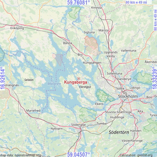
Kungsberga GPS coordinates[2]
59° 24' 17.388" North, 17° 37' 45.336" East
| Map corner | latitude | longitude |
|---|---|---|
| Upper-left | 59.76081°, | 16.92614° |
| Center: | 59.40483°, | 17.62926° |
| Lower-right: | 59.04507°, | 18.33239° |
| Map W x H: | 79.6×79.6 km | = 49.5×49.5mi |
| max Lat: | 67.85572° ⇑35.8% North |
| Kungsberga: | 59.40483° |
| min Lat: | ⇓64.2% South 55.34337° |
| min Long | Kungsberga | max Long |
| 11.1712° | 17.62926° | 24.13676° |
| W 80.7%⇐ | ⇒19.3% E |
Elevation
Elevation of Kungsberga is 30 m = 98 ft, and this is 52.6 m = 173 ft below average elevation for this country.
| Max E: |
663 m = 2175 ft | 65.3% |
| Avg. | 82.6 m = 271 ft | |
| Kungsberga | 30 m = 98 ft | |
Min E: |
-1 m = -3 ft | 34.7% |
See also: Sweden elevation on elevation.city.
Geographical zone
Kungsberga is located in North temperate zone (between Tropic of Cancer and the Arctic Circle). Distance of this North polar circle is 796 km =494.6 mi to North.| Distance of | km | miles | from Kungsberga |
|---|---|---|---|
| North Pole | 3401.9 | 2113.8 | to North |
| Arctic Circle | 796 | 494.6 | to North |
| Tropic Cancer | 3999.3 | 2485 | to South |
| Equator | 6605.2 | 4104.3 | to South |


Nearby cities:
15 places around Kungsberga: (largest is in red/bold)
• Akalla
16.1 km =10 mi,  86°
86°
• Bro
12.4 km =7.7 mi,  1°
1°
• Brunna
14.2 km =8.8 mi,  28°
28°
• Ekerö
16.4 km =10.2 mi,  140°
140°
• Jakobsberg
11.8 km =7.3 mi,  80°
80°
• Kista
17.9 km =11.1 mi, 90°
• Kungsängen
10.6 km =6.6 mi,  39°
39°
• Råby
16 km =9.9 mi,  332°
332°
• Stenhamra
8.5 km =5.3 mi,  156°
156°
• Sylta
9.7 km =6 mi, 30°
• Tensta
15.4 km =9.6 mi, 94°
• Tureholm
11 km =6.8 mi,  153°
153°
• Viksäter
18.2 km =11.3 mi,  182°
182°
• Älvnäs
15.6 km =9.7 mi, 150°
• Ölsta
1.3 km =0.8 mi,  114°
114°
Sources, notices
• [Note1] Compared only with cities in Sweden existing in our database
• [Src1] Map data: © OpenStreetMap contributors (CC-BY-SA)
• [Src2] Other city data from geonames.org with taken over terms of usage.
• [Src3] Geographical zone / Annual Mean Temperature by Robert A. Rohde @ Wikipedia
