Sigtuna geodata
Sigtuna (Stockholm) is a seat of a second-order administrative division; located in Sweden in Europe/Stockholm (GMT+2) time zone. With population of 9,074 people, there are 165 cities with bigger population in this country. Compared to other cities in Sweden, 68.6% of cities are located further ↓South; 81.8% of cities are located further ←West and 80.1% of cities have higher elevation than Sigtuna. Note1


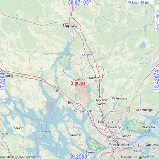
Sigtuna GPS coordinates[2]
59° 37' 2.316" North, 17° 43' 24.996" East
| Map corner | latitude | longitude |
|---|---|---|
| Upper-left | 59.97105°, | 17.02049° |
| Center: | 59.61731°, | 17.72361° |
| Lower-right: | 59.2598°, | 18.42674° |
| Map W x H: | 79.1×79.1 km | = 49.2×49.2mi |
| max Lat: | 67.85572° ⇑31.4% North |
| Sigtuna: | 59.61731° |
| min Lat: | ⇓68.6% South 55.34337° |
| min Long | Sigtuna | max Long |
| 11.1712° | 17.72361° | 24.13676° |
| W 81.8%⇐ | ⇒18.2% E |
Elevation
Elevation of Sigtuna is 16 m = 52 ft, and this is 66.6 m = 219 ft below average elevation for this country.
| Max E: |
663 m = 2175 ft | 80.1% |
| Avg. | 82.6 m = 271 ft | |
| Sigtuna | 16 m = 52 ft | |
Min E: |
-1 m = -3 ft | 19.9% |
See also: Sweden elevation on elevation.city.
Geographical zone
Sigtuna is located in North temperate zone (between Tropic of Cancer and the Arctic Circle). Distance of this North polar circle is 772.4 km =479.9 mi to North.| Distance of | km | miles | from Sigtuna |
|---|---|---|---|
| North Pole | 3378.2 | 2099.1 | to North |
| Arctic Circle | 772.4 | 479.9 | to North |
| Tropic Cancer | 4022.9 | 2499.7 | to South |
| Equator | 6628.8 | 4118.9 | to South |


Nearby cities:
15 places around Sigtuna: (largest is in red/bold)
• Alsike
15.4 km =9.6 mi,  10°
10°
• Bro
12.3 km =7.6 mi,  204°
204°
• Brunna
11.3 km =7 mi,  172°
172°
• Bålsta
12.4 km =7.7 mi,  243°
243°
• Knivsta
12.6 km =7.8 mi,  16°
16°
• Kungsängen
15.5 km =9.6 mi, 174°
• Lindholmen
21.5 km =13.4 mi,  100°
100°
• Märsta
7.4 km =4.6 mi,  86°
86°
• Rosersberg
9.7 km =6 mi,  112°
112°
• Råby
15.7 km =9.8 mi,  233°
233°
• Steninge
4.9 km =3 mi, 110°
• Sylta
15.3 km =9.5 mi,  181°
181°
• Upplands Väsby
15.3 km =9.5 mi,  136°
136°
• Vallentuna
22 km =13.7 mi, 114°
• Ytternäs
19.7 km =12.2 mi,  339°
339°
Sources, notices
• [Note1] Compared only with cities in Sweden existing in our database
• [Src1] Map data: © OpenStreetMap contributors (CC-BY-SA)
• [Src2] Other city data from geonames.org with taken over terms of usage.
• [Src3] Geographical zone / Annual Mean Temperature by Robert A. Rohde @ Wikipedia
