Ödåkra geodata
Ödåkra (Skåne) is a populated place; located in Sweden in Europe/Stockholm (GMT+2) time zone. With population of 5,231 people, there are 260 cities with bigger population in this country. Compared to other cities in Sweden, 90.5% of cities are located further ↑North; 85.5% of cities are located further →East and 65.8% of cities have higher elevation than Ödåkra. Note1
Administrative division(s):
- Level 1: Skåne
- Level 2: Helsingborg
- Level 3: Fleninge
- Level 4: Fleninge socken


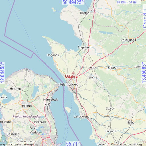
Ödåkra GPS coordinates[2]
56° 6' 14.832" North, 12° 44' 51.72" East
| Map corner | latitude | longitude |
|---|---|---|
| Upper-left | 56.49425°, | 12.04458° |
| Center: | 56.10412°, | 12.7477° |
| Lower-right: | 55.71°, | 13.45083° |
| Map W x H: | 87.2×87.2 km | = 54.2×54.2mi |
| max Lat: | 67.85572° ⇑90.5% North |
| Ödåkra: | 56.10412° |
| min Lat: | ⇓9.5% South 55.34337° |
| min Long | Ödåkra | max Long |
| 11.1712° | 12.7477° | 24.13676° |
| W 14.5%⇐ | ⇒85.5% E |
Elevation
Elevation of Ödåkra is 29 m = 95 ft, and this is 53.6 m = 176 ft below average elevation for this country.
| Max E: |
663 m = 2175 ft | 65.8% |
| Avg. | 82.6 m = 271 ft | |
| Ödåkra | 29 m = 95 ft | |
Min E: |
-1 m = -3 ft | 34.2% |
See also: Sweden elevation on elevation.city.
Geographical zone
Ödåkra is located in North temperate zone (between Tropic of Cancer and the Arctic Circle). Distance of this North polar circle is 1163 km =722.7 mi to North.| Distance of | km | miles | from Ödåkra |
|---|---|---|---|
| North Pole | 3768.9 | 2341.9 | to North |
| Arctic Circle | 1163 | 722.7 | to North |
| Tropic Cancer | 3632.3 | 2257 | to South |
| Equator | 6238.2 | 3876.2 | to South |


Nearby cities:
15 places around Ödåkra: (largest is in red/bold)
• Allerum
3.8 km =2.4 mi,  298°
298°
• Bjuv
10.9 km =6.8 mi,  102°
102°
• Bårslöv
11.2 km =7 mi,  161°
161°
• Domsten
8.9 km =5.5 mi,  280°
280°
• Gantofta
13.5 km =8.4 mi, 164°
• Hasslarp
5.4 km =3.4 mi,  52°
52°
• Helsingborg
7.2 km =4.5 mi,  207°
207°
• Hittarp
7.1 km =4.4 mi,  266°
266°
• Hyllinge
6.4 km =4 mi,  94°
94°
• Kattarp
4.6 km =2.9 mi,  28°
28°
• Mörarp
9.7 km =6 mi,  122°
122°
• Påarp
9 km =5.6 mi,  151°
151°
• Strövelstorp
9.2 km =5.7 mi,  37°
37°
• Viken
11.9 km =7.4 mi, 295°
• Åstorp
12.7 km =7.9 mi,  73°
73°
Sources, notices
• [Note1] Compared only with cities in Sweden existing in our database
• [Src1] Map data: © OpenStreetMap contributors (CC-BY-SA)
• [Src2] Other city data from geonames.org with taken over terms of usage.
• [Src3] Geographical zone / Annual Mean Temperature by Robert A. Rohde @ Wikipedia
