Gantofta geodata
Gantofta (Skåne) is a populated place; located in Sweden in Europe/Stockholm (GMT+2) time zone. With population of 1,322 people, there are 706 cities with bigger population in this country. Compared to other cities in Sweden, 92.9% of cities are located further ↑North; 84.6% of cities are located further →East and 61.1% of cities have higher elevation than Gantofta. Note1
Administrative division(s):
- Level 1: Skåne
- Level 2: Helsingborg
- Level 3: Kvistofta
- Level 4: Kvistofta socken


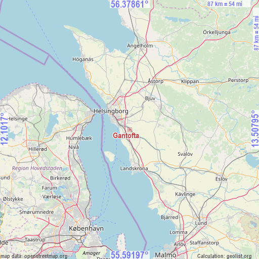
Gantofta GPS coordinates[2]
55° 59' 14.244" North, 12° 48' 17.352" East
| Map corner | latitude | longitude |
|---|---|---|
| Upper-left | 56.37861°, | 12.1017° |
| Center: | 55.98729°, | 12.80482° |
| Lower-right: | 55.59197°, | 13.50795° |
| Map W x H: | 87.5×87.5 km | = 54.4×54.4mi |
| max Lat: | 67.85572° ⇑92.9% North |
| Gantofta: | 55.98729° |
| min Lat: | ⇓7.1% South 55.34337° |
| min Long | Gantofta | max Long |
| 11.1712° | 12.80482° | 24.13676° |
| W 15.4%⇐ | ⇒84.6% E |
Elevation
Elevation of Gantofta is 34 m = 112 ft, and this is 48.6 m = 159 ft below average elevation for this country.
| Max E: |
663 m = 2175 ft | 61.1% |
| Avg. | 82.6 m = 271 ft | |
| Gantofta | 34 m = 112 ft | |
Min E: |
-1 m = -3 ft | 38.9% |
See also: Sweden elevation on elevation.city.
Geographical zone
Gantofta is located in North temperate zone (between Tropic of Cancer and the Arctic Circle). Distance of this North polar circle is 1176 km =730.7 mi to North.| Distance of | km | miles | from Gantofta |
|---|---|---|---|
| North Pole | 3781.9 | 2350 | to North |
| Arctic Circle | 1176 | 730.7 | to North |
| Tropic Cancer | 3619.3 | 2248.9 | to South |
| Equator | 6225.2 | 3868.2 | to South |


Nearby cities:
15 places around Gantofta: (largest is in red/bold)
• Asmundtorp
14.1 km =8.8 mi,  145°
145°
• Billesholm
14 km =8.7 mi,  60°
60°
• Bjuv
12.9 km =8 mi,  33°
33°
• Bårslöv
2.4 km =1.5 mi,  1°
1°
• Ekeby
10.2 km =6.3 mi,  82°
82°
• Glumslöv
5.2 km =3.2 mi,  176°
176°
• Hasslarp
16.3 km =10.1 mi, 2°
• Helsingborg
9.5 km =5.9 mi,  313°
313°
• Hyllinge
12.8 km =8 mi,  12°
12°
• Landskrona
13 km =8.1 mi,  173°
173°
• Mörarp
9.1 km =5.7 mi, 30°
• Påarp
5.2 km =3.2 mi, 8°
• Rydebäck
3.3 km =2.1 mi,  225°
225°
• Vallåkra
4.3 km =2.7 mi,  132°
132°
• Ödåkra
13.5 km =8.4 mi,  344°
344°
Sources, notices
• [Note1] Compared only with cities in Sweden existing in our database
• [Src1] Map data: © OpenStreetMap contributors (CC-BY-SA)
• [Src2] Other city data from geonames.org with taken over terms of usage.
• [Src3] Geographical zone / Annual Mean Temperature by Robert A. Rohde @ Wikipedia
