Norsholm geodata
Norsholm (Östergötland) is a populated place; located in Sweden in Europe/Stockholm (GMT+2) time zone. With population of 566 people, there are 1212 cities with bigger population in this country. Compared to other cities in Sweden, 52.5% of cities are located further ↑North; 61.5% of cities are located further ←West and 56.3% of cities have higher elevation than Norsholm. Note1


Norsholm GPS coordinates[2]
58° 30' 19.404" North, 15° 58' 20.748" East
| Map corner | latitude | longitude |
|---|---|---|
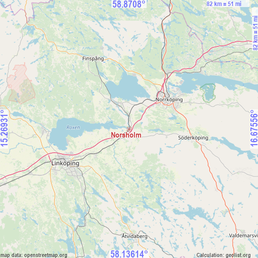
| Upper-left | 58.8708°, | 15.26931° |
| Center: | 58.50539°, | 15.97243° |
| Lower-right: | 58.13614°, | 16.67556° |
| Map W x H: | 81.7×81.7 km | = 50.8×50.8mi |
| max Lat: | 67.85572° ⇑52.5% North |
| Norsholm: | 58.50539° |
| min Lat: | ⇓47.5% South 55.34337° |
| min Long | Norsholm | max Long |
| 11.1712° | 15.97243° | 24.13676° |
| W 61.5%⇐ | ⇒38.5% E |
Elevation
Elevation of Norsholm is 40 m = 131 ft, and this is 42.6 m = 140 ft below average elevation for this country.
| Max E: |
663 m = 2175 ft | 56.3% |
| Avg. | 82.6 m = 271 ft | |
| Norsholm | 40 m = 131 ft | |
Min E: |
-1 m = -3 ft | 43.7% |
See also: Sweden elevation on elevation.city.
Geographical zone
Norsholm is located in North temperate zone (between Tropic of Cancer and the Arctic Circle). Distance of this North polar circle is 896 km =556.7 mi to North.| Distance of | km | miles | from Norsholm |
|---|---|---|---|
| North Pole | 3501.9 | 2176 | to North |
| Arctic Circle | 896 | 556.7 | to North |
| Tropic Cancer | 3899.3 | 2422.9 | to South |
| Equator | 6505.2 | 4042.1 | to South |


Nearby cities:
15 places around Norsholm: (largest is in red/bold)
• Askeby
13 km =8.1 mi,  213°
213°
• Ekängen
20.2 km =12.6 mi,  257°
257°
• Jursla
21.7 km =13.5 mi,  34°
34°
• Kimstad
5 km =3.1 mi,  353°
353°
• Lindö
20.3 km =12.6 mi,  52°
52°
• Linghem
13.6 km =8.5 mi,  233°
233°
• Ljunga
22 km =13.7 mi,  86°
86°
• Norrköping
15.7 km =9.8 mi, 50°
• Ruda
18.6 km =11.6 mi,  320°
320°
• Skärblacka
8 km =5 mi,  328°
328°
• Svärtinge
17 km =10.6 mi,  10°
10°
• Söderköping
20.5 km =12.7 mi,  97°
97°
• Tallboda
19.1 km =11.9 mi,  242°
242°
• Åby
21.7 km =13.5 mi, 34°
• Öbonäs
13.4 km =8.3 mi,  71°
71°
Sources, notices
• [Note1] Compared only with cities in Sweden existing in our database
• [Src1] Map data: © OpenStreetMap contributors (CC-BY-SA)
• [Src2] Other city data from geonames.org with taken over terms of usage.
• [Src3] Geographical zone / Annual Mean Temperature by Robert A. Rohde @ Wikipedia
