Svärtinge geodata
Svärtinge (Östergötland) is a populated place; located in Sweden in Europe/Stockholm (GMT+2) time zone. With population of 3,326 people, there are 374 cities with bigger population in this country. Compared to other cities in Sweden, 50.4% of cities are located further ↑North; 62.2% of cities are located further ←West and 67.8% of cities have lower elevation than Svärtinge. Note1


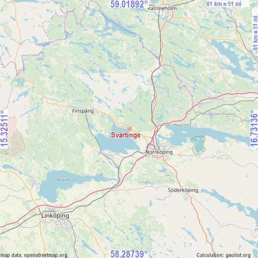
Svärtinge GPS coordinates[2]
58° 39' 18.252" North, 16° 1' 41.628" East
| Map corner | latitude | longitude |
|---|---|---|
| Upper-left | 59.01892°, | 15.32511° |
| Center: | 58.65507°, | 16.02823° |
| Lower-right: | 58.28739°, | 16.73136° |
| Map W x H: | 81.3×81.3 km | = 50.5×50.5mi |
| max Lat: | 67.85572° ⇑50.4% North |
| Svärtinge: | 58.65507° |
| min Lat: | ⇓49.6% South 55.34337° |
| min Long | Svärtinge | max Long |
| 11.1712° | 16.02823° | 24.13676° |
| W 62.2%⇐ | ⇒37.8% E |
Elevation
Elevation of Svärtinge is 92 m = 302 ft, and this is 9.4 m = 31 ft above average elevation for this country.
| Max E: |
663 m = 2175 ft | 32.2% |
| Svärtinge | 92 m 302 ft | |
| Avg. | 82.6 m = 271 ft | |
Min E: |
-1 m = -3 ft | 67.8% |
See also: Sweden elevation on elevation.city.
Geographical zone
Svärtinge is located in North temperate zone (between Tropic of Cancer and the Arctic Circle). Distance of this North polar circle is 879.3 km =546.4 mi to North.| Distance of | km | miles | from Svärtinge |
|---|---|---|---|
| North Pole | 3485.2 | 2165.6 | to North |
| Arctic Circle | 879.3 | 546.4 | to North |
| Tropic Cancer | 3915.9 | 2433.2 | to South |
| Equator | 6521.8 | 4052.5 | to South |


Nearby cities:
15 places around Svärtinge: (largest is in red/bold)
• Finspång
16.1 km =10 mi,  290°
290°
• Jursla
9.1 km =5.7 mi,  81°
81°
• Kimstad
12.3 km =7.6 mi,  197°
197°
• Krokek
19.7 km =12.2 mi, 84°
• Lindö
13.5 km =8.4 mi,  108°
108°
• Ljunga
24.2 km =15 mi,  129°
129°
• Lotorp
14.2 km =8.8 mi,  307°
307°
• Norrköping
11.2 km =7 mi, 127°
• Norsholm
17 km =10.6 mi,  190°
190°
• Rejmyre
20.8 km =12.9 mi,  342°
342°
• Ruda
15.3 km =9.5 mi,  260°
260°
• Skärblacka
12.3 km =7.6 mi,  217°
217°
• Strömsfors
17.7 km =11 mi, 80°
• Åby
9.1 km =5.7 mi, 81°
• Öbonäs
15.6 km =9.7 mi,  142°
142°
Sources, notices
• [Note1] Compared only with cities in Sweden existing in our database
• [Src1] Map data: © OpenStreetMap contributors (CC-BY-SA)
• [Src2] Other city data from geonames.org with taken over terms of usage.
• [Src3] Geographical zone / Annual Mean Temperature by Robert A. Rohde @ Wikipedia
