Ljunga geodata
Ljunga (Östergötland) is a populated place; located in Sweden in Europe/Stockholm (GMT+2) time zone. With population of 722 people, there are 1039 cities with bigger population in this country. Compared to other cities in Sweden, 52.4% of cities are located further ↑North; 66.1% of cities are located further ←West and 51.8% of cities have higher elevation than Ljunga. Note1


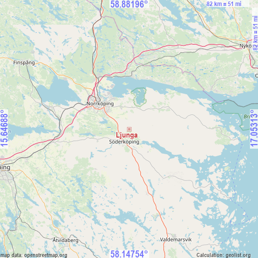
Ljunga GPS coordinates[2]
58° 31' 0.012" North, 16° 21' 0" East
| Map corner | latitude | longitude |
|---|---|---|
| Upper-left | 58.88196°, | 15.64688° |
| Center: | 58.51667°, | 16.35° |
| Lower-right: | 58.14754°, | 17.05313° |
| Map W x H: | 81.7×81.7 km | = 50.8×50.8mi |
| max Lat: | 67.85572° ⇑52.4% North |
| Ljunga: | 58.51667° |
| min Lat: | ⇓47.6% South 55.34337° |
| min Long | Ljunga | max Long |
| 11.1712° | 16.35° | 24.13676° |
| W 66.1%⇐ | ⇒33.9% E |
Elevation
Elevation of Ljunga is 47 m = 154 ft, and this is 35.6 m = 117 ft below average elevation for this country.
| Max E: |
663 m = 2175 ft | 51.8% |
| Avg. | 82.6 m = 271 ft | |
| Ljunga | 47 m = 154 ft | |
Min E: |
-1 m = -3 ft | 48.2% |
See also: Sweden elevation on elevation.city.
Geographical zone
Ljunga is located in North temperate zone (between Tropic of Cancer and the Arctic Circle). Distance of this North polar circle is 894.7 km =555.9 mi to North.| Distance of | km | miles | from Ljunga |
|---|---|---|---|
| North Pole | 3500.6 | 2175.2 | to North |
| Arctic Circle | 894.7 | 555.9 | to North |
| Tropic Cancer | 3900.5 | 2423.7 | to South |
| Equator | 6506.4 | 4042.9 | to South |


Nearby cities:
15 places around Ljunga: (largest is in red/bold)
• Gusum
28.9 km =18 mi,  162°
162°
• Jursla
19.3 km =12 mi,  329°
329°
• Kimstad
22.8 km =14.2 mi,  279°
279°
• Krokek
17.3 km =10.7 mi,  3°
3°
• Lindö
12.5 km =7.8 mi, 332°
• Norrköping
13 km =8.1 mi,  311°
311°
• Norsholm
22 km =13.7 mi,  266°
266°
• Ringarum
21.2 km =13.2 mi, 164°
• Skärblacka
26.7 km =16.6 mi, 282°
• Strömsfors
18.2 km =11.3 mi,  356°
356°
• Svärtinge
24.2 km =15 mi, 309°
• Söderköping
4.3 km =2.7 mi,  201°
201°
• Åby
19.3 km =12 mi, 329°
• Öbonäs
9.7 km =6 mi,  287°
287°
• Östra Husby
13.8 km =8.6 mi,  57°
57°
Sources, notices
• [Note1] Compared only with cities in Sweden existing in our database
• [Src1] Map data: © OpenStreetMap contributors (CC-BY-SA)
• [Src2] Other city data from geonames.org with taken over terms of usage.
• [Src3] Geographical zone / Annual Mean Temperature by Robert A. Rohde @ Wikipedia
