Näsåker geodata
Näsåker (Västernorrland) is a populated place; located in Sweden in Europe/Stockholm (GMT+2) time zone. With population of 526 people, there are 1279 cities with bigger population in this country. Compared to other cities in Sweden, 91.2% of cities are located further ↓South; 72.6% of cities are located further ←West and 79.9% of cities have lower elevation than Näsåker. Note1


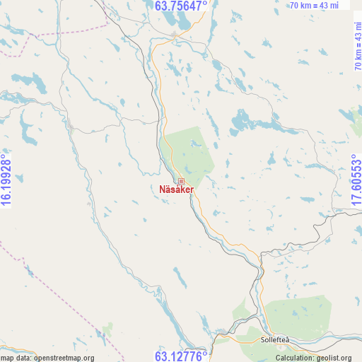
Näsåker GPS coordinates[2]
63° 26' 37.824" North, 16° 54' 8.64" East
| Map corner | latitude | longitude |
|---|---|---|
| Upper-left | 63.75647°, | 16.19928° |
| Center: | 63.44384°, | 16.9024° |
| Lower-right: | 63.12776°, | 17.60553° |
| Map W x H: | 69.9×69.9 km | = 43.4×43.4mi |
| max Lat: | 67.85572° ⇑8.8% North |
| Näsåker: | 63.44384° |
| min Lat: | ⇓91.2% South 55.34337° |
| min Long | Näsåker | max Long |
| 11.1712° | 16.9024° | 24.13676° |
| W 72.6%⇐ | ⇒27.4% E |
Elevation
Elevation of Näsåker is 144 m = 472 ft, and this is 61.4 m = 201 ft above average elevation for this country.
| Max E: |
663 m = 2175 ft | 20.1% |
| Näsåker | 144 m 472 ft | |
| Avg. | 82.6 m = 271 ft | |
Min E: |
-1 m = -3 ft | 79.9% |
See also: Sweden elevation on elevation.city.
Geographical zone
Näsåker is located in North temperate zone (between Tropic of Cancer and the Arctic Circle). Distance of this North polar circle is 346.9 km =215.6 mi to North.| Distance of | km | miles | from Näsåker |
|---|---|---|---|
| North Pole | 2952.8 | 1834.8 | to North |
| Arctic Circle | 346.9 | 215.6 | to North |
| Tropic Cancer | 4448.4 | 2764.1 | to South |
| Equator | 7054.3 | 4383.3 | to South |


Nearby cities:
15 places around Näsåker: (largest is in red/bold)
• Backe
48.3 km =30 mi,  329°
329°
• Bollstabruk
62.9 km =39.1 mi,  142°
142°
• Bredbyn
60 km =37.3 mi,  89°
89°
• Hammarstrand
46.1 km =28.6 mi,  216°
216°
• Junsele
28 km =17.4 mi,  357°
357°
• Kramfors
71.9 km =44.7 mi, 142°
• Kungsgården
67.9 km =42.2 mi, 136°
• Långsele
30.1 km =18.7 mi,  164°
164°
• Mellansel
70.3 km =43.7 mi, 91°
• Nyland
64.9 km =40.3 mi, 138°
• Ramsele
24 km =14.9 mi,  296°
296°
• Sollefteå
35.8 km =22.2 mi,  149°
149°
• Stugun
72 km =44.7 mi,  244°
244°
• Torsåker
59.6 km =37 mi,  134°
134°
• Ås
18.1 km =11.2 mi, 241°
Sources, notices
• [Note1] Compared only with cities in Sweden existing in our database
• [Src1] Map data: © OpenStreetMap contributors (CC-BY-SA)
• [Src2] Other city data from geonames.org with taken over terms of usage.
• [Src3] Geographical zone / Annual Mean Temperature by Robert A. Rohde @ Wikipedia
