Hammarstrand geodata
Hammarstrand (Jämtland) is a seat of a second-order administrative division; located in Sweden in Europe/Stockholm (GMT+2) time zone. With population of 1,116 people, there are 766 cities with bigger population in this country. Compared to other cities in Sweden, 89.3% of cities are located further ↓South; 66.2% of cities are located further ←West and 75.9% of cities have lower elevation than Hammarstrand. Note1


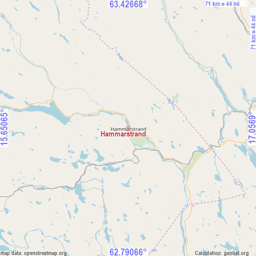
Hammarstrand GPS coordinates[2]
63° 6' 37.476" North, 16° 21' 13.572" East
| Map corner | latitude | longitude |
|---|---|---|
| Upper-left | 63.42668°, | 15.65065° |
| Center: | 63.11041°, | 16.35377° |
| Lower-right: | 62.79066°, | 17.0569° |
| Map W x H: | 70.7×70.7 km | = 43.9×43.9mi |
| max Lat: | 67.85572° ⇑10.7% North |
| Hammarstrand: | 63.11041° |
| min Lat: | ⇓89.3% South 55.34337° |
| min Long | Hammarstrand | max Long |
| 11.1712° | 16.35377° | 24.13676° |
| W 66.2%⇐ | ⇒33.8% E |
Elevation
Elevation of Hammarstrand is 124 m = 407 ft, and this is 41.4 m = 136 ft above average elevation for this country.
| Max E: |
663 m = 2175 ft | 24.1% |
| Hammarstrand | 124 m 407 ft | |
| Avg. | 82.6 m = 271 ft | |
Min E: |
-1 m = -3 ft | 75.9% |
See also: Sweden elevation on elevation.city.
Geographical zone
Hammarstrand is located in North temperate zone (between Tropic of Cancer and the Arctic Circle). Distance of this North polar circle is 384 km =238.6 mi to North.| Distance of | km | miles | from Hammarstrand |
|---|---|---|---|
| North Pole | 2989.8 | 1857.8 | to North |
| Arctic Circle | 384 | 238.6 | to North |
| Tropic Cancer | 4411.3 | 2741.1 | to South |
| Equator | 7017.2 | 4360.3 | to South |


Nearby cities:
15 places around Hammarstrand: (largest is in red/bold)
• Bollstabruk
67.7 km =42.1 mi,  100°
100°
• Bräcke
61.8 km =38.4 mi,  229°
229°
• Fränsta
68.7 km =42.7 mi,  187°
187°
• Gällö
60.7 km =37.7 mi,  248°
248°
• Hållsta
71 km =44.1 mi,  260°
260°
• Indal
70.3 km =43.7 mi,  147°
147°
• Junsele
70.2 km =43.6 mi,  22°
22°
• Ljungaverk
70.8 km =44 mi, 192°
• Långsele
36.7 km =22.8 mi,  77°
77°
• Näsåker
46.1 km =28.6 mi,  36°
36°
• Ramsele
48 km =29.8 mi,  6°
6°
• Sollefteå
46.3 km =28.8 mi, 82°
• Stugun
38.4 km =23.9 mi,  279°
279°
• Torsåker
70.4 km =43.7 mi,  93°
93°
• Ås
30.7 km =19.1 mi, 21°
Sources, notices
• [Note1] Compared only with cities in Sweden existing in our database
• [Src1] Map data: © OpenStreetMap contributors (CC-BY-SA)
• [Src2] Other city data from geonames.org with taken over terms of usage.
• [Src3] Geographical zone / Annual Mean Temperature by Robert A. Rohde @ Wikipedia
