Linköping geodata
Linköping (Östergötland) is a seat of a first-order administrative division; located in Sweden in Europe/Stockholm (GMT+2) time zone. With population of 106,502 people, there are 8 cities with bigger population in this country. Compared to other cities in Sweden, 54.2% of cities are located further ↑North; 57.4% of cities are located further ←West and 54.4% of cities have lower elevation than Linköping. Note1
Administrative division(s):
- Level 1: Östergötland
- Level 2: Linköpings Kommun
- Level 3: Linköpings S:t Lars
- Level 4: Linköping socken


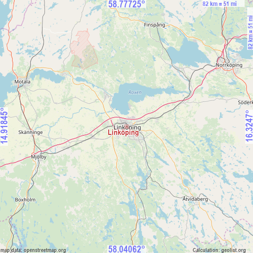
Linköping GPS coordinates[2]
58° 24' 39.096" North, 15° 37' 17.652" East
| Map corner | latitude | longitude |
|---|---|---|
| Upper-left | 58.77725°, | 14.91845° |
| Center: | 58.41086°, | 15.62157° |
| Lower-right: | 58.04062°, | 16.3247° |
| Map W x H: | 81.9×81.9 km | = 50.9×50.9mi |
| max Lat: | 67.85572° ⇑54.2% North |
| Linköping: | 58.41086° |
| min Lat: | ⇓45.8% South 55.34337° |
| min Long | Linköping | max Long |
| 11.1712° | 15.62157° | 24.13676° |
| W 57.4%⇐ | ⇒42.6% E |
Elevation
Elevation of Linköping is 58 m = 190 ft, and this is 24.6 m = 81 ft below average elevation for this country.
| Max E: |
663 m = 2175 ft | 45.6% |
| Avg. | 82.6 m = 271 ft | |
| Linköping | 58 m = 190 ft | |
Min E: |
-1 m = -3 ft | 54.4% |
See also: Linköping elevation on elevation.city.
Geographical zone
Linköping is located in North temperate zone (between Tropic of Cancer and the Arctic Circle). Distance of this North polar circle is 906.5 km =563.3 mi to North.| Distance of | km | miles | from Linköping |
|---|---|---|---|
| North Pole | 3512.4 | 2182.5 | to North |
| Arctic Circle | 906.5 | 563.3 | to North |
| Tropic Cancer | 3888.8 | 2416.4 | to South |
| Equator | 6494.7 | 4035.6 | to South |


Nearby cities:
15 places around Linköping: (largest is in red/bold)
• Askeby
13.2 km =8.2 mi,  91°
91°
• Berg
10.1 km =6.3 mi,  328°
328°
• Bestorp
20.8 km =12.9 mi,  161°
161°
• Ekängen
6.2 km =3.9 mi,  6°
6°
• Grebo
19 km =11.8 mi,  129°
129°
• Linghem
9.7 km =6 mi,  75°
75°
• Ljungsbro
13.7 km =8.5 mi, 328°
• Malmslätt
6.1 km =3.8 mi,  270°
270°
• Mantorp
20.8 km =12.9 mi,  251°
251°
• Norsholm
23 km =14.3 mi,  62°
62°
• Skärblacka
23.7 km =14.7 mi,  43°
43°
• Slaka
6.4 km =4 mi,  220°
220°
• Sturefors
10.8 km =6.7 mi,  142°
142°
• Tallboda
3.8 km =2.4 mi,  65°
65°
• Vikingstad
11.5 km =7.1 mi, 254°
Sources, notices
• [Note1] Compared only with cities in Sweden existing in our database
• [Src1] Map data: © OpenStreetMap contributors (CC-BY-SA)
• [Src2] Other city data from geonames.org with taken over terms of usage.
• [Src3] Geographical zone / Annual Mean Temperature by Robert A. Rohde @ Wikipedia
