Igelstorp geodata
Igelstorp (Västra Götaland) is a populated place; located in Sweden in Europe/Stockholm (GMT+2) time zone. With population of 648 people, there are 1122 cities with bigger population in this country. Compared to other cities in Sweden, 54.3% of cities are located further ↑North; 64.8% of cities are located further →East and 77.5% of cities have lower elevation than Igelstorp. Note1


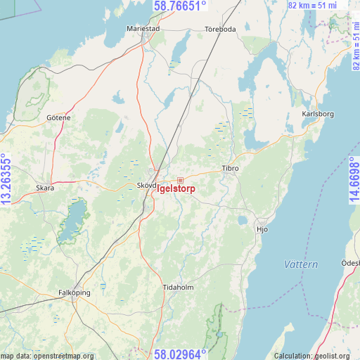
Igelstorp GPS coordinates[2]
58° 24' 0" North, 13° 58' 0.012" East
| Map corner | latitude | longitude |
|---|---|---|
| Upper-left | 58.76651°, | 13.26355° |
| Center: | 58.4°, | 13.96667° |
| Lower-right: | 58.02964°, | 14.6698° |
| Map W x H: | 81.9×81.9 km | = 50.9×50.9mi |
| max Lat: | 67.85572° ⇑54.3% North |
| Igelstorp: | 58.4° |
| min Lat: | ⇓45.7% South 55.34337° |
| min Long | Igelstorp | max Long |
| 11.1712° | 13.96667° | 24.13676° |
| W 35.2%⇐ | ⇒64.8% E |
Elevation
Elevation of Igelstorp is 130 m = 427 ft, and this is 47.4 m = 156 ft above average elevation for this country.
| Max E: |
663 m = 2175 ft | 22.5% |
| Igelstorp | 130 m 427 ft | |
| Avg. | 82.6 m = 271 ft | |
Min E: |
-1 m = -3 ft | 77.5% |
See also: Sweden elevation on elevation.city.
Geographical zone
Igelstorp is located in North temperate zone (between Tropic of Cancer and the Arctic Circle). Distance of this North polar circle is 907.7 km =564 mi to North.| Distance of | km | miles | from Igelstorp |
|---|---|---|---|
| North Pole | 3513.6 | 2183.2 | to North |
| Arctic Circle | 907.7 | 564 | to North |
| Tropic Cancer | 3887.6 | 2415.6 | to South |
| Equator | 6493.5 | 4034.9 | to South |


Nearby cities:
15 places around Igelstorp: (largest is in red/bold)
• Fagersanna
20.8 km =12.9 mi,  69°
69°
• Hjo
21.7 km =13.5 mi,  120°
120°
• Lerdala
17.2 km =10.7 mi,  300°
300°
• Moholm
23.3 km =14.5 mi,  10°
10°
• Olofstorp
16.8 km =10.4 mi,  173°
173°
• Skultorp
9.6 km =6 mi,  234°
234°
• Skövde
7.2 km =4.5 mi,  262°
262°
• Stenstorp
20.4 km =12.7 mi, 226°
• Stöpen
10.5 km =6.5 mi,  325°
325°
• Tibro
11.7 km =7.3 mi,  76°
76°
• Tidan
19.5 km =12.1 mi, 6°
• Timmersdala
19.5 km =12.1 mi,  319°
319°
• Varnhem
18.5 km =11.5 mi, 264°
• Väring
11.7 km =7.3 mi,  0°
0°
• Värsås
7.4 km =4.6 mi,  138°
138°
Sources, notices
• [Note1] Compared only with cities in Sweden existing in our database
• [Src1] Map data: © OpenStreetMap contributors (CC-BY-SA)
• [Src2] Other city data from geonames.org with taken over terms of usage.
• [Src3] Geographical zone / Annual Mean Temperature by Robert A. Rohde @ Wikipedia
