Moholm geodata
Moholm (Västra Götaland) is a populated place; located in Sweden in Europe/Stockholm (GMT+2) time zone. With population of 647 people, there are 1126 cities with bigger population in this country. Compared to other cities in Sweden, 50.8% of cities are located further ↑North; 64.1% of cities are located further →East and 65.1% of cities have lower elevation than Moholm. Note1


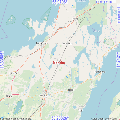
Moholm GPS coordinates[2]
58° 36' 23.22" North, 14° 2' 20.292" East
| Map corner | latitude | longitude |
|---|---|---|
| Upper-left | 58.9708°, | 13.33585° |
| Center: | 58.60645°, | 14.03897° |
| Lower-right: | 58.23826°, | 14.7421° |
| Map W x H: | 81.5×81.4 km | = 50.6×50.6mi |
| max Lat: | 67.85572° ⇑50.8% North |
| Moholm: | 58.60645° |
| min Lat: | ⇓49.2% South 55.34337° |
| min Long | Moholm | max Long |
| 11.1712° | 14.03897° | 24.13676° |
| W 35.9%⇐ | ⇒64.1% E |
Elevation
Elevation of Moholm is 82 m = 269 ft, and this is 0.59999999999999 m = 2 ft below average elevation for this country.
| Max E: |
663 m = 2175 ft | 34.9% |
| Avg. | 82.6 m = 271 ft | |
| Moholm | 82 m = 269 ft | |
Min E: |
-1 m = -3 ft | 65.1% |
See also: Sweden elevation on elevation.city.
Geographical zone
Moholm is located in North temperate zone (between Tropic of Cancer and the Arctic Circle). Distance of this North polar circle is 884.7 km =549.7 mi to North.| Distance of | km | miles | from Moholm |
|---|---|---|---|
| North Pole | 3490.6 | 2169 | to North |
| Arctic Circle | 884.7 | 549.7 | to North |
| Tropic Cancer | 3910.5 | 2429.9 | to South |
| Equator | 6516.4 | 4049.1 | to South |


Nearby cities:
15 places around Moholm: (largest is in red/bold)
• Fagersanna
21.7 km =13.5 mi,  135°
135°
• Igelstorp
23.3 km =14.5 mi,  190°
190°
• Karlsborg
28.1 km =17.5 mi,  105°
105°
• Lerdala
23.7 km =14.7 mi,  233°
233°
• Lugnås
20 km =12.4 mi,  281°
281°
• Mariestad
16.9 km =10.5 mi,  312°
312°
• Mölltorp
24.1 km =15 mi,  119°
119°
• Skövde
26.5 km =16.5 mi,  205°
205°
• Stöpen
17.5 km =10.9 mi,  215°
215°
• Tibro
21.4 km =13.3 mi,  160°
160°
• Tidan
4 km =2.5 mi, 209°
• Timmersdala
18.6 km =11.6 mi,  244°
244°
• Töreboda
12.3 km =7.6 mi,  24°
24°
• Ullervad
12 km =7.5 mi,  303°
303°
• Väring
12 km =7.5 mi,  199°
199°
Sources, notices
• [Note1] Compared only with cities in Sweden existing in our database
• [Src1] Map data: © OpenStreetMap contributors (CC-BY-SA)
• [Src2] Other city data from geonames.org with taken over terms of usage.
• [Src3] Geographical zone / Annual Mean Temperature by Robert A. Rohde @ Wikipedia
