Hyltebruk geodata
Hyltebruk (Halland) is a seat of a second-order administrative division; located in Sweden in Europe/Stockholm (GMT+2) time zone. With population of 3,992 people, there are 320 cities with bigger population in this country. Compared to other cities in Sweden, 77.8% of cities are located further ↑North; 75.1% of cities are located further →East and 74.8% of cities have lower elevation than Hyltebruk. Note1


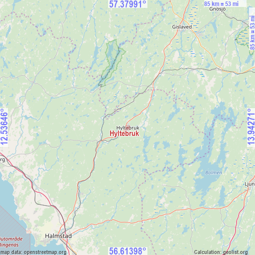
Hyltebruk GPS coordinates[2]
56° 59' 56.112" North, 13° 14' 22.488" East
| Map corner | latitude | longitude |
|---|---|---|
| Upper-left | 57.37991°, | 12.53646° |
| Center: | 56.99892°, | 13.23958° |
| Lower-right: | 56.61398°, | 13.94271° |
| Map W x H: | 85.2×85.2 km | = 52.9×52.9mi |
| max Lat: | 67.85572° ⇑77.8% North |
| Hyltebruk: | 56.99892° |
| min Lat: | ⇓22.2% South 55.34337° |
| min Long | Hyltebruk | max Long |
| 11.1712° | 13.23958° | 24.13676° |
| W 24.9%⇐ | ⇒75.1% E |
Elevation
Elevation of Hyltebruk is 119 m = 390 ft, and this is 36.4 m = 119 ft above average elevation for this country.
| Max E: |
663 m = 2175 ft | 25.2% |
| Hyltebruk | 119 m 390 ft | |
| Avg. | 82.6 m = 271 ft | |
Min E: |
-1 m = -3 ft | 74.8% |
See also: Sweden elevation on elevation.city.
Geographical zone
Hyltebruk is located in North temperate zone (between Tropic of Cancer and the Arctic Circle). Distance of this North polar circle is 1063.5 km =660.8 mi to North.| Distance of | km | miles | from Hyltebruk |
|---|---|---|---|
| North Pole | 3669.4 | 2280.1 | to North |
| Arctic Circle | 1063.5 | 660.8 | to North |
| Tropic Cancer | 3731.8 | 2318.8 | to South |
| Equator | 6337.7 | 3938.1 | to South |


Nearby cities:
15 places around Hyltebruk: (largest is in red/bold)
• Bredaryd
35.8 km =22.2 mi,  57°
57°
• Burseryd
22.5 km =14 mi,  6°
6°
• Getinge
36.8 km =22.9 mi,  236°
236°
• Holm
37.1 km =23.1 mi,  219°
219°
• Kvibille
34.4 km =21.4 mi,  225°
225°
• Lidhult
21.8 km =13.5 mi,  147°
147°
• Oskarström
27.6 km =17.1 mi, 216°
• Reftele
29 km =18 mi,  47°
47°
• Simlångsdalen
31.5 km =19.6 mi,  191°
191°
• Smålandsstenar
21 km =13 mi,  29°
29°
• Torup
10.9 km =6.8 mi, 244°
• Ullared
35 km =21.7 mi,  295°
295°
• Unnaryd
17.7 km =11 mi,  107°
107°
• Vessigebro
35.8 km =22.2 mi,  267°
267°
• Åled
33.4 km =20.8 mi,  213°
213°
Sources, notices
• [Note1] Compared only with cities in Sweden existing in our database
• [Src1] Map data: © OpenStreetMap contributors (CC-BY-SA)
• [Src2] Other city data from geonames.org with taken over terms of usage.
• [Src3] Geographical zone / Annual Mean Temperature by Robert A. Rohde @ Wikipedia
