Genevad geodata
Genevad (Halland) is a populated place; located in Sweden in Europe/Stockholm (GMT+2) time zone. With population of 653 people, there are 1117 cities with bigger population in this country. Compared to other cities in Sweden, 82.9% of cities are located further ↑North; 79% of cities are located further →East and 72.8% of cities have higher elevation than Genevad. Note1


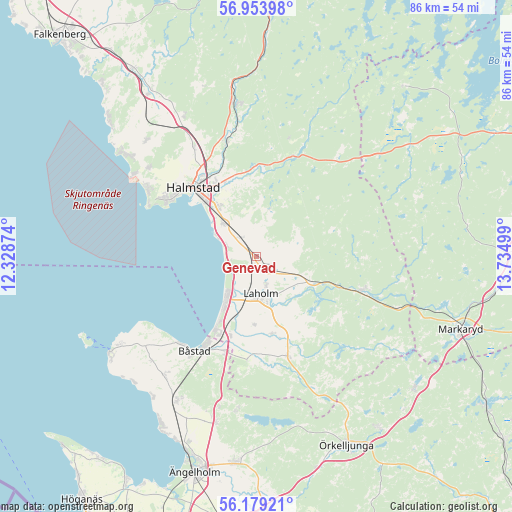
Genevad GPS coordinates[2]
56° 34' 6.888" North, 13° 1' 54.696" East
| Map corner | latitude | longitude |
|---|---|---|
| Upper-left | 56.95398°, | 12.32874° |
| Center: | 56.56858°, | 13.03186° |
| Lower-right: | 56.17921°, | 13.73499° |
| Map W x H: | 86.1×86.1 km | = 53.5×53.5mi |
| max Lat: | 67.85572° ⇑82.9% North |
| Genevad: | 56.56858° |
| min Lat: | ⇓17.1% South 55.34337° |
| min Long | Genevad | max Long |
| 11.1712° | 13.03186° | 24.13676° |
| W 21%⇐ | ⇒79% E |
Elevation
Elevation of Genevad is 22 m = 72 ft, and this is 60.6 m = 199 ft below average elevation for this country.
| Max E: |
663 m = 2175 ft | 72.8% |
| Avg. | 82.6 m = 271 ft | |
| Genevad | 22 m = 72 ft | |
Min E: |
-1 m = -3 ft | 27.2% |
See also: Sweden elevation on elevation.city.
Geographical zone
Genevad is located in North temperate zone (between Tropic of Cancer and the Arctic Circle). Distance of this North polar circle is 1111.3 km =690.5 mi to North.| Distance of | km | miles | from Genevad |
|---|---|---|---|
| North Pole | 3717.2 | 2309.8 | to North |
| Arctic Circle | 1111.3 | 690.5 | to North |
| Tropic Cancer | 3683.9 | 2289.1 | to South |
| Equator | 6289.8 | 3908.3 | to South |


Nearby cities:
15 places around Genevad: (largest is in red/bold)
• Eldsberga
4 km =2.5 mi,  330°
330°
• Fyllinge
11.5 km =7.1 mi,  322°
322°
• Gullbranna
5.6 km =3.5 mi,  297°
297°
• Halmstad
15.9 km =9.9 mi, 317°
• Kyrkhult
14.5 km =9 mi,  98°
98°
• Laholm
6.3 km =3.9 mi,  173°
173°
• Lilla Tjärby
4.9 km =3 mi,  161°
161°
• Mellbystrand
10.8 km =6.7 mi,  211°
211°
• Simlångsdalen
18.1 km =11.2 mi,  19°
19°
• Skottorp
14 km =8.7 mi,  198°
198°
• Trönninge
8.1 km =5 mi,  311°
311°
• Vallberga
11.4 km =7.1 mi,  184°
184°
• Veinge
3 km =1.9 mi,  134°
134°
• Våxtorp
17.7 km =11 mi, 162°
• Östra Karup
16.9 km =10.5 mi, 200°
Sources, notices
• [Note1] Compared only with cities in Sweden existing in our database
• [Src1] Map data: © OpenStreetMap contributors (CC-BY-SA)
• [Src2] Other city data from geonames.org with taken over terms of usage.
• [Src3] Geographical zone / Annual Mean Temperature by Robert A. Rohde @ Wikipedia
